
IMAGES TAKEN NEAR TO
Thomas Maddison Lane, WAKEFIELD, WF4 3GH
Introduction
This page details the photographs taken nearby to Thomas Maddison Lane, WF4 3GH by members of the Geograph project.
The Geograph project started in 2005 with the aim of publishing, organising and preserving representative images for every square kilometre of Great Britain, Ireland and the Isle of Man.

There are currently over 7.5m images from over14,400 individuals and you can help contribute to the project by visiting https://www.geograph.org.uk
Image Map
Images are licensed for reuse under creativecommons.org/licenses/by-sa/2.0
Notes
- Clicking on the map will re-center to the selected point.
- The higher the marker number, the further away the image location is from the centre of the postcode.
Image Listing (14 Images Found)
Images are licensed for reuse under creativecommons.org/licenses/by-sa/2.0
Image
Details
Distance
1
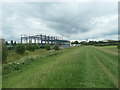
Construction site, off Peel Avenue, Calder Park
A new building between the forensics laboratory and the Highways Agency's regional centre. The floodbank with the path protects the business park from the River Calder when it floods.
Image: © Christine Johnstone
Taken: 20 Jun 2020
0.13 miles
2
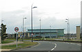
Calder Park
A business park just off the M1 Junction 39.
Image: © Pauline E
Taken: 24 Mar 2010
0.15 miles
3
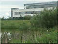
Heron on the southern shore, western lake, Calder Park
The lakes are part of a flood defence scheme.
Image: © Christine Johnstone
Taken: 20 Jun 2020
0.15 miles
4
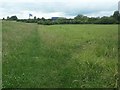
Footpath junction below the floodbank, Calder Park
Straight on [south-west] to go under the M1. Right / north to go anti-clockwise round the western lake.
Image: © Christine Johnstone
Taken: 20 Jun 2020
0.15 miles
5
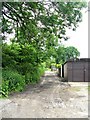
Bridleway - Denby Dale Road, Durkar
Image: © Betty Longbottom
Taken: 17 Jun 2008
0.17 miles
6
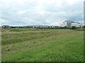
Drainage at Calder Park, Wakefield
Taken from the flood bank around the western lake. There is also a flood bank on the opposite side of the drain. The whole area is in the flood plain of the River Calder. The nearest large building is a forensics laboratory.
Image: © Christine Johnstone
Taken: 20 Jun 2020
0.17 miles
7

Floodbank protecting building in Calder Park
The business park is built in the flood plain of the River Calder. This floodbank protects the park from up to 3 metres of flood water which would be held in the basin in the foreground. There is another floodbank along the river itself. The building is the Highway Agency's north-east regional control centre.
Image: © Christine Johnstone
Taken: 20 Jun 2020
0.18 miles
8
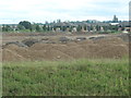
Development site, Calder Park
A Peel Holdings business park just off junction 39 on the M1.
Image: © Christine Johnstone
Taken: 20 Jun 2020
0.18 miles
9
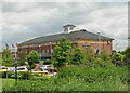
Express - Holiday Inn - Denby Dale Road, Durkar
Image: © Betty Longbottom
Taken: 17 Jun 2008
0.19 miles
10
Red Kite - Denby Dale Road, Durkar
Image: © Betty Longbottom
Taken: 17 Jun 2008
0.22 miles