IMAGES TAKEN NEAR TO
Broad Cut Road, WAKEFIELD, WF4 3DR

Introduction

This page details the photographs taken nearby to Broad Cut Road, WF4 3DR by members of the Geograph project.

The Geograph project started in 2005 with the aim of publishing, organising and preserving representative images for every square kilometre of Great Britain, Ireland and the Isle of Man.

There are currently over 7.5m images from over14,400 individuals and you can help contribute to the project by visiting https://www.geograph.org.uk

Image Map


Images are licensed for reuse under creativecommons.org/licenses/by-sa/2.0
Notes
  • Clicking on the map will re-center to the selected point.
  • The higher the marker number, the further away the image location is from the centre of the postcode.

Image Listing (93 Images Found)

Images are licensed for reuse under creativecommons.org/licenses/by-sa/2.0
  • ...
Image
Details
Distance
1
Footpath - Broad Cut Road
Image: © Betty Longbottom Taken: 12 Jan 2016
0.01 miles
2
Gas Installation - Broad Cut Road
Image: © Betty Longbottom Taken: 12 Jan 2016
0.02 miles
3
Broad Cut Road - Denby Dale Road
Image: © Betty Longbottom Taken: 12 Jan 2016
0.02 miles
4
Stream - Broad Cut Road
Image: © Betty Longbottom Taken: 12 Jan 2016
0.03 miles
5
Denby Dale Road - viewed from Hollin Lane
Image: © Betty Longbottom Taken: 12 Jan 2016
0.04 miles
6
Footpath - Broad Cut Road
Image: © Betty Longbottom Taken: 12 Jan 2016
0.04 miles
7
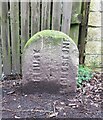
Old Boundary Marker on Broad Cut Road
Township or Parish Boundary Marker on the east side of Broad Cut Road, between the A636 Wakefield Road / Denby Dale Road to the south and the Calder and Hebble Navigation to the north. On the boundary of Horbury and Crigglestone. Horbury was a chapelry in Wakefield parish and Crigglestone a township in Sandal Magna parish until 1866 when they both became parishes. Horbury became unparished in 1974. Milestone Society National ID: YW_CRIHOR01pb
Image: © R Heywood Taken: 1 Mar 2024
0.05 miles
8
Stream - Broad Cut Road
Image: © Betty Longbottom Taken: 12 Jan 2016
0.05 miles
9
Denby Dale Road - viewed from Hollin Lane
Image: © Betty Longbottom Taken: 12 Jan 2016
0.05 miles
10
Hollin Lane - Denby Dale Road
Image: © Betty Longbottom Taken: 12 Jan 2016
0.06 miles
  • ...