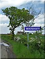
IMAGES TAKEN NEAR TO
WF4 2FT
Introduction
This page details the photographs taken nearby to WF4 2FT by members of the Geograph project.
The Geograph project started in 2005 with the aim of publishing, organising and preserving representative images for every square kilometre of Great Britain, Ireland and the Isle of Man.

There are currently over 7.5m images from over14,400 individuals and you can help contribute to the project by visiting https://www.geograph.org.uk
Image Map
Images are licensed for reuse under creativecommons.org/licenses/by-sa/2.0
Notes
- Clicking on the map will re-center to the selected point.
- The higher the marker number, the further away the image location is from the centre of the postcode.
Image Listing (36 Images Found)
Images are licensed for reuse under creativecommons.org/licenses/by-sa/2.0
Image
Details
Distance
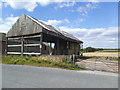
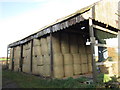
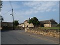
5
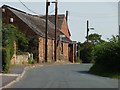
Barn with a corrugated iron roof
At the junction of Wintersett Lane and Back Lane.
Image: © Christine Johnstone
Taken: 3 Aug 2011
0.03 miles
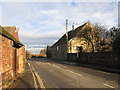
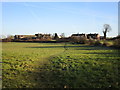
6

Houses in Wintersett
Perhaps originally council or coal board houses?
Image: © Christine Johnstone
Taken: 3 Aug 2011
0.06 miles
9
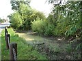
Small roadside pond, Wintersett
The post-and-rope barrier gives a garden atmosphere.
Image: © Christine Johnstone
Taken: 3 Aug 2011
0.10 miles
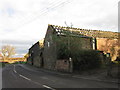
10
New housing development in Wintersett
Heavily renovated or pseudo-vernacular?
Image: © Christine Johnstone
Taken: 3 Aug 2011
0.12 miles