
IMAGES TAKEN NEAR TO
Ryhill Pits Lane, WAKEFIELD, WF4 2DU
Introduction
This page details the photographs taken nearby to Ryhill Pits Lane, WF4 2DU by members of the Geograph project.
The Geograph project started in 2005 with the aim of publishing, organising and preserving representative images for every square kilometre of Great Britain, Ireland and the Isle of Man.

There are currently over 7.5m images from over14,400 individuals and you can help contribute to the project by visiting https://www.geograph.org.uk
Image Map
Images are licensed for reuse under creativecommons.org/licenses/by-sa/2.0
Notes
- Clicking on the map will re-center to the selected point.
- The higher the marker number, the further away the image location is from the centre of the postcode.
Image Listing (13 Images Found)
Images are licensed for reuse under creativecommons.org/licenses/by-sa/2.0
Image
Details
Distance


3
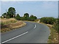
Cold Hiendley speed limits
30mph would be pretty fast on Ryhill Pits Lane, with all its right angle bends.
Image: © Christine Johnstone
Taken: 3 Aug 2011
0.11 miles
4

Wheatfield west of Ryhill Pits Lane
A slight rise in the land blocks out everything else from view.
Image: © Christine Johnstone
Taken: 3 Aug 2011
0.12 miles
5
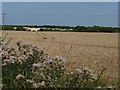
Thistles at the edge of a wheatfield
Looking north from Ryhill Pits Lane.
Image: © Christine Johnstone
Taken: 3 Aug 2011
0.12 miles
6

Ryhill Pits Lane
East of Cold Hiendley.
Image: © Christine Johnstone
Taken: 3 Aug 2011
0.14 miles
7

Green boundary between golden fields
Wheatfields east of Ryhill Pits Lane.
Image: © Christine Johnstone
Taken: 3 Aug 2011
0.14 miles
8
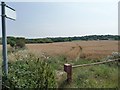
Footpath across a wheatfield
It looks like the tractors follow the curved public footpath route and the walkers take the unofficial straight route.
Image: © Christine Johnstone
Taken: 3 Aug 2011
0.17 miles
9
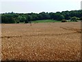
Wheatfield in front of Ryhill Pits
Ryhill Pits is the wooded area in the distance. It is open access land.
Image: © Christine Johnstone
Taken: 3 Aug 2011
0.20 miles
10

Eastern end of Cold Hiendley Reservoir.
Looking E. In the distance can be seen the embankment that separates Cold Hiendley from Wintersett reservoir and its overflow. In the extreme distance is Ryhill.
Image: © Steve Partridge
Taken: 4 Dec 2005
0.21 miles