IMAGES TAKEN NEAR TO
Thorntree Avenue, WAKEFIELD, WF4 1NR
Introduction
This page details the photographs taken nearby to Thorntree Avenue, WF4 1NR by members of the Geograph project.
The Geograph project started in 2005 with the aim of publishing, organising and preserving representative images for every square kilometre of Great Britain, Ireland and the Isle of Man.

There are currently over 7.5m images from over14,400 individuals and you can help contribute to the project by visiting https://www.geograph.org.uk
Image Map
Images are licensed for reuse under creativecommons.org/licenses/by-sa/2.0
Notes
- Clicking on the map will re-center to the selected point.
- The higher the marker number, the further away the image location is from the centre of the postcode.
Image Listing (35 Images Found)
Images are licensed for reuse under creativecommons.org/licenses/by-sa/2.0
Image
Details
Distance
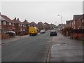
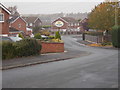
5
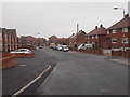
Hawthorn Avenue - looking towards Thorntree Avenue
Image: © Betty Longbottom
Taken: 3 Nov 2015
0.04 miles
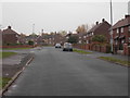
7
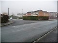
The junction of two different parts of Brand Hill Drive
Image: © Christine Johnstone
Taken: 19 Jan 2010
0.07 miles
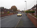
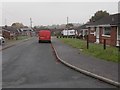
10
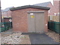
Electricity Substation No 3136 - Hawthorn Avenue
Image: © Betty Longbottom
Taken: 3 Nov 2015
0.09 miles