
IMAGES TAKEN NEAR TO
Crossley Street, WAKEFIELD, WF4 1BQ
Introduction
This page details the photographs taken nearby to Crossley Street, WF4 1BQ by members of the Geograph project.
The Geograph project started in 2005 with the aim of publishing, organising and preserving representative images for every square kilometre of Great Britain, Ireland and the Isle of Man.

There are currently over 7.5m images from over14,400 individuals and you can help contribute to the project by visiting https://www.geograph.org.uk
Image Map
Images are licensed for reuse under creativecommons.org/licenses/by-sa/2.0
Notes
- Clicking on the map will re-center to the selected point.
- The higher the marker number, the further away the image location is from the centre of the postcode.
Image Listing (15 Images Found)
Images are licensed for reuse under creativecommons.org/licenses/by-sa/2.0
Image
Details
Distance
1

Houses facing fields, New Sharlston
Only one side of Crossley Street was developed.
Image: © Christine Johnstone
Taken: 3 Feb 2010
0.02 miles
2

Crossley Street, New Sharlston, at the junction with Long Row
Image: © Christine Johnstone
Taken: 3 Feb 2010
0.03 miles
3

New Sharlston's Long Row lives up to its name
Typical nineteenth century miners' houses. Each colliery had its own brickworks.
Image: © Christine Johnstone
Taken: 3 Feb 2010
0.04 miles
4

Crossley Street, New Sharlston.
Looking SE.
Image: © Steve Partridge
Taken: 20 Feb 2006
0.07 miles
5

Long Row, New Sharlston.
Looking E.
Image: © Steve Partridge
Taken: 20 Feb 2006
0.07 miles


8

Crossley Street
Crossley Street in New Sharlston.
Image: © Philip Halling
Taken: 29 Jun 2018
0.16 miles
9
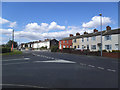
High Street, New Sharlston
This is the village centre: not much to see here and the name 'High Street' may seem pretentious. But the road is on the route of a Roman one, and 'High Street' often seems to have been used for such routes.
Image: © Stephen Craven
Taken: 31 Aug 2020
0.21 miles
10

Sharlston Colliery Wheel
Sharlston Colliery Wheel is a monument to the coal mine which closed in 1993.
Image: © Philip Halling
Taken: 29 Jun 2018
0.21 miles