
IMAGES TAKEN NEAR TO
Bottom Boat Road, WAKEFIELD, WF3 4AX
Introduction
This page details the photographs taken nearby to Bottom Boat Road, WF3 4AX by members of the Geograph project.
The Geograph project started in 2005 with the aim of publishing, organising and preserving representative images for every square kilometre of Great Britain, Ireland and the Isle of Man.

There are currently over 7.5m images from over14,400 individuals and you can help contribute to the project by visiting https://www.geograph.org.uk
Image Map
Images are licensed for reuse under creativecommons.org/licenses/by-sa/2.0
Notes
- Clicking on the map will re-center to the selected point.
- The higher the marker number, the further away the image location is from the centre of the postcode.
Image Listing (41 Images Found)
Images are licensed for reuse under creativecommons.org/licenses/by-sa/2.0
Image
Details
Distance
3
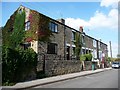
Stone-built terraced houses
At the eastern end of Bottom Boat village.
Image: © Christine Johnstone
Taken: 14 Aug 2010
0.02 miles
4

Properties in Bottomboat
The bottom of Bottomboat. No further properties extend beyond these pictured here.
Image: © Mike Kirby
Taken: 24 Apr 2010
0.02 miles
5
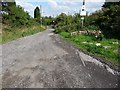
Buried railway tracks
The remains of a narrow gauge mineral line, buried in the road.
Image: © Christine Johnstone
Taken: 14 Aug 2010
0.05 miles
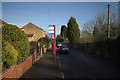
7
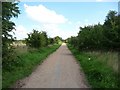
The former Methley Joint railway line
With a passenger service until the late 1960s. Now a footpath and cycleway, part of the Trans Pennine Trail.
Image: © Christine Johnstone
Taken: 14 Aug 2010
0.09 miles
8

Oil seed rape coming into flower
Just east of Bottomboat.
Image: © Christine Johnstone
Taken: 19 May 2020
0.10 miles
9
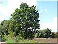
Tree alongside the former railway line
Was this here when the railway closed?
Image: © Christine Johnstone
Taken: 14 Aug 2010
0.10 miles
10
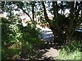
Informal path to Moorhouse
To join the Trans Pennine Trail at this point, cut through the gap in the fence and scramble up the embankment.
Image: © Christine Johnstone
Taken: 14 Aug 2010
0.11 miles