IMAGES TAKEN NEAR TO
Green Lane, WAKEFIELD, WF3 3QH
Introduction
This page details the photographs taken nearby to Green Lane, WF3 3QH by members of the Geograph project.
The Geograph project started in 2005 with the aim of publishing, organising and preserving representative images for every square kilometre of Great Britain, Ireland and the Isle of Man.

There are currently over 7.5m images from over14,400 individuals and you can help contribute to the project by visiting https://www.geograph.org.uk
Image Map
Images are licensed for reuse under creativecommons.org/licenses/by-sa/2.0
Notes
- Clicking on the map will re-center to the selected point.
- The higher the marker number, the further away the image location is from the centre of the postcode.
Image Listing (17 Images Found)
Images are licensed for reuse under creativecommons.org/licenses/by-sa/2.0
Image
Details
Distance
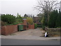
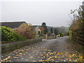
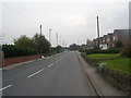
2
Ouzlewell Green - viewed from Green Lane
Image: © Betty Longbottom
Taken: 30 Oct 2009
0.05 miles
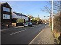
3
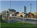
Bus stop at Ouzlewell Green
On Arriva's 444 route from Wakefield to Leeds.
Image: © Stephen Craven
Taken: 23 Jul 2019
0.06 miles
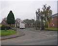
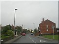
4
Ouzlewell Green - viewed from Green Lane
Image: © Betty Longbottom
Taken: 30 Oct 2009
0.06 miles
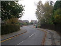
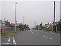
5
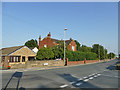
Ouzlewell Green
The name (formerly spelled Ouzelwell) was once that of a small village, including a Methodist chapel. It now only lives on in the name of this road.
Image: © Stephen Craven
Taken: 23 Jul 2019
0.08 miles