IMAGES TAKEN NEAR TO
Colliery Approach, Potovens Lane, WAKEFIELD, WF3 3JG
Introduction
This page details the photographs taken nearby to Colliery Approach, Potovens Lane, WF3 3JG by members of the Geograph project.
The Geograph project started in 2005 with the aim of publishing, organising and preserving representative images for every square kilometre of Great Britain, Ireland and the Isle of Man.

There are currently over 7.5m images from over14,400 individuals and you can help contribute to the project by visiting https://www.geograph.org.uk
Image Map
Images are licensed for reuse under creativecommons.org/licenses/by-sa/2.0
Notes
- Clicking on the map will re-center to the selected point.
- The higher the marker number, the further away the image location is from the centre of the postcode.
Image Listing (89 Images Found)
Images are licensed for reuse under creativecommons.org/licenses/by-sa/2.0
Image
Details
Distance
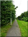
5
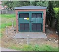
Electricity Substation No 5721 - Potovens Lane
Image: © Betty Longbottom
Taken: 1 Oct 2013
0.06 miles
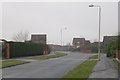
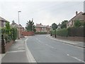
6
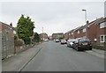
Chandlers Close - off Potovens Lane
Image: © Betty Longbottom
Taken: 1 Oct 2013
0.06 miles
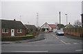
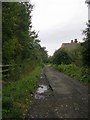
10
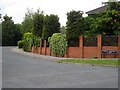
Colliery Approach
Follow this road to the end of the cul-de-sac to gain access to Lofthouse Colliery Park. http://www.lofthousecag.co.uk/first.html
Image: © Mike Kirby
Taken: 24 Jun 2009
0.08 miles