IMAGES TAKEN NEAR TO
Owlett Mead, WAKEFIELD, WF3 3DQ
Introduction
This page details the photographs taken nearby to Owlett Mead, WF3 3DQ by members of the Geograph project.
The Geograph project started in 2005 with the aim of publishing, organising and preserving representative images for every square kilometre of Great Britain, Ireland and the Isle of Man.

There are currently over 7.5m images from over14,400 individuals and you can help contribute to the project by visiting https://www.geograph.org.uk
Image Map
Images are licensed for reuse under creativecommons.org/licenses/by-sa/2.0
Notes
- Clicking on the map will re-center to the selected point.
- The higher the marker number, the further away the image location is from the centre of the postcode.
Image Listing (78 Images Found)
Images are licensed for reuse under creativecommons.org/licenses/by-sa/2.0
Image
Details
Distance
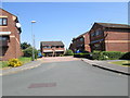
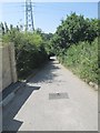
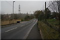
2
Owlett Mead - looking towards Stanhope Mead
Image: © Betty Longbottom
Taken: 16 Jul 2013
0.01 miles
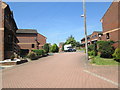
6
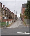
Daisy Vale Terrace - Stanhope Road
Image: © Betty Longbottom
Taken: 31 Oct 2012
0.05 miles
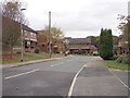
7
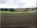
Across the field
Across the newly planted fields are houses in Thorpe
Image: © SMJ
Taken: 2 Aug 2008
0.06 miles
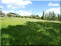
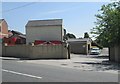
10
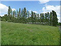
Row of poplars at Owlett Hall Farm
It was quite a windy day, as these tall trees evidence.
Image: © Stephen Craven
Taken: 22 May 2020
0.06 miles