IMAGES TAKEN NEAR TO
Daisy Lane, WAKEFIELD, WF3 2ND
Introduction
This page details the photographs taken nearby to Daisy Lane, WF3 2ND by members of the Geograph project.
The Geograph project started in 2005 with the aim of publishing, organising and preserving representative images for every square kilometre of Great Britain, Ireland and the Isle of Man.

There are currently over 7.5m images from over14,400 individuals and you can help contribute to the project by visiting https://www.geograph.org.uk
Image Map
Images are licensed for reuse under creativecommons.org/licenses/by-sa/2.0
Notes
- Clicking on the map will re-center to the selected point.
- The higher the marker number, the further away the image location is from the centre of the postcode.
Image Listing (50 Images Found)
Images are licensed for reuse under creativecommons.org/licenses/by-sa/2.0
Image
Details
Distance
1
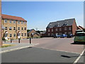
Houses on Daisy Lane
The 'lane' is actually a road in a modern housing development.
Image: © Stephen Craven
Taken: 22 May 2020
0.01 miles
2
Daisy Lane - viewed from near Beck Way
Image: © Betty Longbottom
Taken: 16 Jul 2013
0.02 miles
3
Violet Road - viewed from Beck Way
Image: © Betty Longbottom
Taken: 16 Jul 2013
0.04 miles
4
Houses on Violet Road, East Ardsley
Taken from Beck Way.
Image: © Ian S
Taken: 4 Apr 2014
0.05 miles
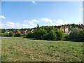
5
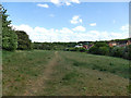
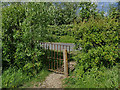
Field with bridleway near Lingwell Gate Farm
Despite the rural appearance this is close to the M1/M62 intersection (a lorry on the M1 can be glimpsed in the background).
Image: © Stephen Craven
Taken: 22 May 2020
0.05 miles
6
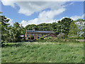
Lingwell Gate Farm
Viewed from the bridleway passing below the farmhouse.
Image: © Stephen Craven
Taken: 22 May 2020
0.06 miles
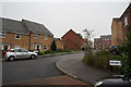
7
Bracken Square - end of Bluebell Road
Image: © Betty Longbottom
Taken: 16 Jul 2013
0.06 miles
8
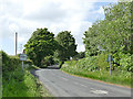
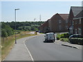
Passing place on Lingwell Gate Lane
The road is not single track, so I presume this is intended as a place for slow moving agricultural vehicles to let others overtake.
Image: © Stephen Craven
Taken: 22 May 2020
0.06 miles
9
Gate onto Lingwell Gate Lane
The end of the bridleway from Station Road.
Image: © Stephen Craven
Taken: 22 May 2020
0.07 miles
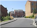
10
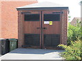
Electricity Substation No 48362 - Bracken Square
Image: © Betty Longbottom
Taken: 16 Jul 2013
0.07 miles