
IMAGES TAKEN NEAR TO
Bradford Road, WAKEFIELD, WF3 2JA
Introduction
This page details the photographs taken nearby to Bradford Road, WF3 2JA by members of the Geograph project.
The Geograph project started in 2005 with the aim of publishing, organising and preserving representative images for every square kilometre of Great Britain, Ireland and the Isle of Man.

There are currently over 7.5m images from over14,400 individuals and you can help contribute to the project by visiting https://www.geograph.org.uk
Image Map
Images are licensed for reuse under creativecommons.org/licenses/by-sa/2.0
Notes
- Clicking on the map will re-center to the selected point.
- The higher the marker number, the further away the image location is from the centre of the postcode.
Image Listing (91 Images Found)
Images are licensed for reuse under creativecommons.org/licenses/by-sa/2.0
Image
Details
Distance
1
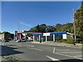
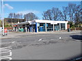
Esso filling station, Bradford Road, East Ardsley
With a Tesco Express as part of the offering.
Image: © Stephen Craven
Taken: 15 Oct 2023
0.01 miles
2
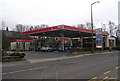
Esso Filling Station - Bradford Road
Image: © Betty Longbottom
Taken: 26 Jan 2008
0.01 miles
4
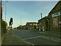
Puffin crossing, Bradford Road, East Ardsley
The A650 is a busy road at times, despite a ban on through HGV traffic, so the crossing is much needed. Less so on a Sunday afternoon.
Image: © Stephen Craven
Taken: 15 Oct 2023
0.03 miles
5
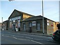
The Carpet Mill, Bradford Road, East Ardsley
Another contributor identifies this as a former Methodist chapel of 1869 Image
Image: © Stephen Craven
Taken: 15 Oct 2023
0.03 miles
7
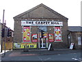
The Carpet Mill - Bradford Road
Former Methodist Free Church - originally built in 1869.
Image: © Betty Longbottom
Taken: 15 Feb 2013
0.04 miles
8
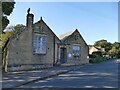
St Michael's church hall, Church Lane, East Ardsley
The right hand side is the original Sunday School of 1837, and on the left the 'Jubilee Wing' of 1897.
Image: © Stephen Craven
Taken: 15 Oct 2023
0.04 miles
9
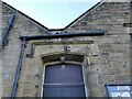
St Michael's church hall, Church Lane, East Ardsley (detail)
Above the door are dates of construction (1837) and extension (1897). See Image for context.
Image: © Stephen Craven
Taken: 15 Oct 2023
0.05 miles
10
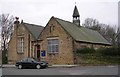
St Michael's Sunday Schools - Cherry Tree Walk
These were enlarged in 1897.
Image: © Betty Longbottom
Taken: 26 Jan 2008
0.05 miles