IMAGES TAKEN NEAR TO
Skipton Close, WAKEFIELD, WF3 2GE
Introduction
This page details the photographs taken nearby to Skipton Close, WF3 2GE by members of the Geograph project.
The Geograph project started in 2005 with the aim of publishing, organising and preserving representative images for every square kilometre of Great Britain, Ireland and the Isle of Man.

There are currently over 7.5m images from over14,400 individuals and you can help contribute to the project by visiting https://www.geograph.org.uk
Image Map
Images are licensed for reuse under creativecommons.org/licenses/by-sa/2.0
Notes
- Clicking on the map will re-center to the selected point.
- The higher the marker number, the further away the image location is from the centre of the postcode.
Image Listing (68 Images Found)
Images are licensed for reuse under creativecommons.org/licenses/by-sa/2.0
Image
Details
Distance
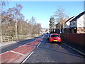
1
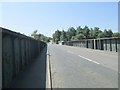
Fall Bridge No DOL2/20 - Fall Lane
Image: © Betty Longbottom
Taken: 16 Jul 2013
0.06 miles
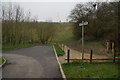
3
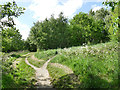
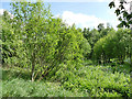
Path junction, Dolphin Beck Marsh
Entering the marshland from the east. This is one of three area comprising the Ardsley and Thorpe Nature Park, the others being East Ardsley Falls and Spring Lane Sidings.
Image: © Stephen Craven
Taken: 22 May 2020
0.06 miles
5
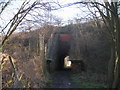
Dolphin Beck Marsh
The marshland is one of three area comprising the Ardsley and Thorpe Nature Park, the others being East Ardsley Falls and Spring Lane Sidings.
Image: © Stephen Craven
Taken: 22 May 2020
0.08 miles
6
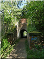
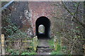
Subway under Stanhope Road
This looks to me like "railway architecture". There never was a railway line through here - it's too narrow anyway - but maybe the arch over an existing footpath was made when the embankment carrying Stanhope Road up and over the railway line was built.
Image: © Stephen Craven
Taken: 22 May 2020
0.09 miles
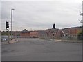
9
Path Junction near Buttercup Lane, East Ardsley
Image: © Ian S
Taken: 4 Apr 2014
0.10 miles
10
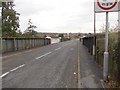
Fall Lane - viewed from Mary Street
Image: © Betty Longbottom
Taken: 19 Feb 2013
0.10 miles