
IMAGES TAKEN NEAR TO
Mulberry Close, WAKEFIELD, WF2 9FS
Introduction
This page details the photographs taken nearby to Mulberry Close, WF2 9FS by members of the Geograph project.
The Geograph project started in 2005 with the aim of publishing, organising and preserving representative images for every square kilometre of Great Britain, Ireland and the Isle of Man.

There are currently over 7.5m images from over14,400 individuals and you can help contribute to the project by visiting https://www.geograph.org.uk
Image Map
Images are licensed for reuse under creativecommons.org/licenses/by-sa/2.0
Notes
- Clicking on the map will re-center to the selected point.
- The higher the marker number, the further away the image location is from the centre of the postcode.
Image Listing (91 Images Found)
Images are licensed for reuse under creativecommons.org/licenses/by-sa/2.0
Image
Details
Distance
1
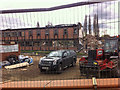
Balne Lane Public Library being demolished
I believe that this will be replaced with 56 affordable homes.
Image: © Andrew Whale
Taken: 10 Apr 2014
0.02 miles
2
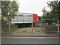
Former Public Library - Balne Lane
Image: © Betty Longbottom
Taken: 11 Nov 2013
0.02 miles
4
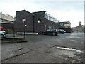
Apartments 1-8, Cliffe Hill Works, Wakefield
A converted office block, off Balne Lane. The conversion received planning permission in 2013.
Image: © Christine Johnstone
Taken: 10 Jan 2021
0.04 miles
5
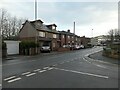
Extended houses, Balne Lane, Wakefield
Sideways and upwards in the last decade.
Image: © Christine Johnstone
Taken: 10 Jan 2021
0.05 miles
6
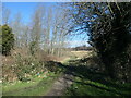
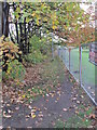
Path from Balne Lane, Wakefield
Heading north into Balne Lane Fields - nine hectares of wooded grassland for informal recreation.
Image: © Christine Johnstone
Taken: 26 Feb 2021
0.05 miles
8

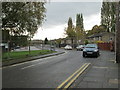
Library Headquarters, Balne Lane, Wakefield
Here is the main reference library, with a very good local studies section, and the West Yorkshire joint collections of music and drama.
Image: © Humphrey Bolton
Taken: 11 Sep 2008
0.06 miles
9
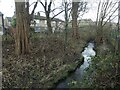
Balne Beck, Wakefield
Looking downstream [south] alongside houses in Elder Green. In the early 1800s, this beck powered textile mills in Wakefield, before water power was replaced by steam. Balne Mill was upstream of here, Westgate Mills downstream.
Image: © Christine Johnstone
Taken: 10 Jan 2021
0.07 miles
10
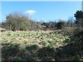
Southern edge, Balne Lane Fields
As far as I can tell from old OS maps, this land has never been built on, despite being very close to the city centre.
Image: © Christine Johnstone
Taken: 26 Feb 2021
0.07 miles