IMAGES TAKEN NEAR TO
Thirlmere Road, WAKEFIELD, WF2 9ER
Introduction
This page details the photographs taken nearby to Thirlmere Road, WF2 9ER by members of the Geograph project.
The Geograph project started in 2005 with the aim of publishing, organising and preserving representative images for every square kilometre of Great Britain, Ireland and the Isle of Man.

There are currently over 7.5m images from over14,400 individuals and you can help contribute to the project by visiting https://www.geograph.org.uk
Image Map
Images are licensed for reuse under creativecommons.org/licenses/by-sa/2.0
Notes
- Clicking on the map will re-center to the selected point.
- The higher the marker number, the further away the image location is from the centre of the postcode.
Image Listing (67 Images Found)
Images are licensed for reuse under creativecommons.org/licenses/by-sa/2.0
Image
Details
Distance
2
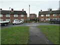
Footpath from Rufford Street to Thirlmere Road
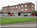
The block of shops in Thirlmere Road date from the mid 1950s. The maisonettes at the western end of Rufford Street were built slightly later.
Image: © Christine Johnstone
Taken: 10 Jan 2021
0.03 miles
3
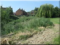
Maisonettes in Thirlmere Road, Flanshaw
On the south bank of Alverthorpe Beck. All the roads in this part of Flanshaw are named after places in the Lake District.
Image: © Christine Johnstone
Taken: 15 Jun 2020
0.03 miles
4
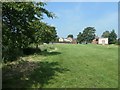
The route of Smithson's Tramroad, near Flanshaw Road
Smithson's Tramroad ran from the distant tree at the end of Wasdale Road to the north bank of Alverthorpe Beck [in the foreground]. It crossed the beck about here to continue east and south towards Thornes Wharf. Opened in 1798, this section fell out of use between the 1850s and the 1880s.
Image: © Christine Johnstone
Taken: 15 Jun 2020
0.03 miles
6
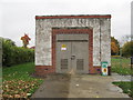
Electricity Substation No 5165 - Flanshaw Road
Image: © Betty Longbottom
Taken: 18 Nov 2013
0.06 miles
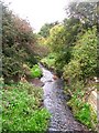
8
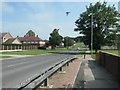
The route of Smithson's Tramroad, at Flanshaw Road
The tramroad opened in 1798, to carry coal from Low Laithes to Thornes Wharf. Here it ran on the north bank of Alverthorpe Beck, crossing the road about where the first tree is on the left / west side. Flanshaw Road wasn't built until the early 1950s, and this section of the tramroad fell out of use between the 1850s and the 1880s, so there never was an actual crossing.
Image: © Christine Johnstone
Taken: 15 Jun 2020
0.06 miles