
IMAGES TAKEN NEAR TO
Cotton Street, WAKEFIELD, WF2 8DZ
Introduction
This page details the photographs taken nearby to Cotton Street, WF2 8DZ by members of the Geograph project.
The Geograph project started in 2005 with the aim of publishing, organising and preserving representative images for every square kilometre of Great Britain, Ireland and the Isle of Man.

There are currently over 7.5m images from over14,400 individuals and you can help contribute to the project by visiting https://www.geograph.org.uk
Image Map
Images are licensed for reuse under creativecommons.org/licenses/by-sa/2.0
Notes
- Clicking on the map will re-center to the selected point.
- The higher the marker number, the further away the image location is from the centre of the postcode.
Image Listing (144 Images Found)
Images are licensed for reuse under creativecommons.org/licenses/by-sa/2.0
Image
Details
Distance
1
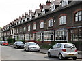
Wakefield - Cotton Street terrace
A further view of this street is available at Image
Image: © Dave Bevis
Taken: 21 May 2010
0.01 miles
5
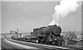
Westbound freight west of Wakefield West Junction
View NE, towards Wakefield West Junction, Wakefield Kirkgate, Normanton etc.: ex-L&Y Calder Valley main line: the bridge in the background carries the ex-GN (West Riding & Grimsby line) from Hare Park Junction and Doncaster (right) to Wakefield Westgate, Leeds and Bradford (left). The Class H freight is headed by ex-WD 2-8-0 No. 90362, which was built in 1/44 as No. 7299 (later 77299) and put into Store at Longmoor until shipped to the Continent in 1/45. After working on the Detmold Military Railway in Germany, it returned to England late in 1947 and was stored at Dovercourt Bay until 6/49 - longer than most, then put to work on the LMR. It was one of the large number of 'Austerities' which ousted the LMS Fowler 7F 0-8-0s on the Central Division and lasted until 6/67.
Image: © Ben Brooksbank
Taken: 18 Mar 1961
0.05 miles
9
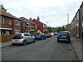
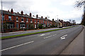
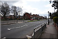
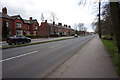
Avondale Street, off Denby Dale Road
The street was laid out between 1905 and 1913, and most of the houses built between 1913 and 1930.
Image: © Christine Johnstone
Taken: 12 May 2020
0.07 miles
10
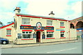
Wakefield, Admiral Duncan Public House
The pub is beside the 99 arches
Image: © Gordon Kneale Brooke
Taken: 3 Sep 2006
0.07 miles