1
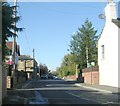
Walton Lane/Castle Road traffic lights
From the A61 heading towards Wakefield.
Image: © Pauline E
Taken: 24 Feb 2014
0.03 miles
2
Church of St Helen, Barnsley Road, Sandal Magna (3)
The gate piers and gates of St Helen’s church are grade II listed and date back to the late C19. Central double and side single wrought iron gates with an overthrow, with scrolled leaf decoration and a lamp holder over the central gate.
LBS Number: 441434
Image: © Mike Kirby
Taken: 1 Mar 2011
0.04 miles
3
Church of St Helen, Barnsley Road, Sandal Magna (3a)
Close up of one of the grade II listed piers and gates, showing the detail. See
Image
Image: © Mike Kirby
Taken: 1 Mar 2011
0.04 miles
4
Parish Church Sandal Magna
Dedicated to St Helen, the church stands close to the site of the Battle of Wakefield.
Image: © Dennis Turner
Taken: 31 Aug 2003
0.04 miles
5
St Helen's Church Graveyard
Sandal Magna parish church graveyard.
Image: © Dennis Turner
Taken: 31 Aug 2003
0.04 miles
6
Malt Kiln Croft - Castle Road
Image: © Betty Longbottom
Taken: 25 Oct 2010
0.05 miles
7
Clevethorpe Grove - Castle Road
Image: © Betty Longbottom
Taken: 25 Oct 2010
0.05 miles
8
Castle Road - Barnsley Road
Image: © Betty Longbottom
Taken: 25 Oct 2010
0.05 miles
9
Sandal House, Barnsley Road
A grade II listed building, part pebble-dashed and painted, with a low pitched stone flagged hipped roof, dated early C19. This may be a re-fronting of an C18 building, as the rear part is of that date.
LBS Number: 441440
Image: © Mike Kirby
Taken: 1 Mar 2011
0.05 miles
10
Location of OS Flush Bracket S9044 - Sandal Magna, St Helen's Church
https://www.bench-marks.org.uk/bm21351
Image: © thejackrustles
Taken: 12 Oct 2021
0.05 miles


