
IMAGES TAKEN NEAR TO
Denby Dale Road, WAKEFIELD, WF2 7BH
Introduction
This page details the photographs taken nearby to Denby Dale Road, WF2 7BH by members of the Geograph project.
The Geograph project started in 2005 with the aim of publishing, organising and preserving representative images for every square kilometre of Great Britain, Ireland and the Isle of Man.

There are currently over 7.5m images from over14,400 individuals and you can help contribute to the project by visiting https://www.geograph.org.uk
Image Map
Images are licensed for reuse under creativecommons.org/licenses/by-sa/2.0
Notes
- Clicking on the map will re-center to the selected point.
- The higher the marker number, the further away the image location is from the centre of the postcode.
Image Listing (60 Images Found)
Images are licensed for reuse under creativecommons.org/licenses/by-sa/2.0
Image
Details
Distance
1
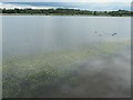
Flowering aquatic plants, eastern lake, Calder Park
Small white blossoms just above the water. A water starwort?
Image: © Christine Johnstone
Taken: 20 Jun 2020
0.06 miles
2

Footpath, eastern shore, eastern lake, Calder Park
A wall replaces the earthen floodbank on this side of the lake. Beyond the wall are the back gardens of homes on Denby Dale Road.
Image: © Christine Johnstone
Taken: 30 May 2020
0.06 miles
3

Shallow edge, eastern lake, Calder Park
This area, on the south bank of the River Calder, has been farmed and quarried for sand and gravel. Now it is part of the Calder valley flood defences as well as public open space. When the river is exceptionally high the eastern and western lakes coalesce behind the 3 metre high floodbank.
Image: © Christine Johnstone
Taken: 30 May 2020
0.06 miles
4

Houses by Denby Dale Road and Sandal Castle, Wakefield
A short terrace of houses on the west side of Denby Dale Road, seen from the other side of the un-named lake. Sandal Castle in the distance, see Image
Image: © Rich Tea
Taken: 29 Jun 2006
0.08 miles
5

Over the gate to the lake, Wakefield
This is the lake on the west side of Denby Dale Road (not Pugneys which is on the east). Not named on the OS map, it appears to be a former quarry. On the horizon in the distance is Emley Moor television transmitter mast at Image
Image: © Rich Tea
Taken: 29 Jun 2006
0.08 miles
6

Pugneys Country Park
This is taken in the SW corner of the square, the small hill in the distance on the left is Sandal Castle.
Image: © Martyn Pattison
Taken: 21 Apr 2005
0.08 miles
7

Calder Terrace, off Denby Dale Road, Wakefield
Built between 1850 and 1892.
Image: © Christine Johnstone
Taken: 20 Jun 2020
0.10 miles
8
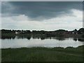
Rain cloud over the eastern lake, Calder Park
Rain threatened, but the cloud continued moving north-eastwards.
Image: © Christine Johnstone
Taken: 20 Jun 2020
0.10 miles
9

Concrete flood barrier, eastern lake, Calder Park
Protecting the back gardens of homes on Denby Dale Road. For privacy, the lakeside path drops down below the wall.
Image: © Christine Johnstone
Taken: 30 May 2020
0.10 miles
10

Calder Park Wetlands Nature Reserve, Wakefield
Image: © habiloid
Taken: 5 Aug 2022
0.10 miles