IMAGES TAKEN NEAR TO
Buttermere Croft, WAKEFIELD, WF2 6TL
Introduction
This page details the photographs taken nearby to Buttermere Croft, WF2 6TL by members of the Geograph project.
The Geograph project started in 2005 with the aim of publishing, organising and preserving representative images for every square kilometre of Great Britain, Ireland and the Isle of Man.

There are currently over 7.5m images from over14,400 individuals and you can help contribute to the project by visiting https://www.geograph.org.uk
Image Map
Images are licensed for reuse under creativecommons.org/licenses/by-sa/2.0
Notes
- Clicking on the map will re-center to the selected point.
- The higher the marker number, the further away the image location is from the centre of the postcode.
Image Listing (64 Images Found)
Images are licensed for reuse under creativecommons.org/licenses/by-sa/2.0
Image
Details
Distance
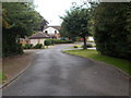
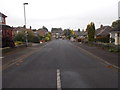
2
Copper Beech Court - Chestnut Avenue
Image: © Betty Longbottom
Taken: 8 Sep 2015
0.04 miles
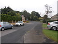
3
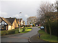
Langdale Mount
A quiet, residential area in the village of Walton.
Image: © Pauline E
Taken: 22 Mar 2010
0.06 miles
4
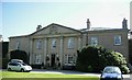
Walton House, Walton
Built in the early C18 with C19 additions
Image: © Stanley Walker
Taken: 24 Aug 2010
0.08 miles
5
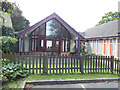
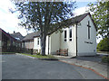
St Paul's church hall, Walton
An extension in 2000 to the adjacent church of 1967 Image
Image: © Stephen Craven
Taken: 31 Aug 2020
0.08 miles
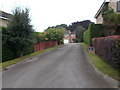
6
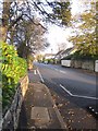
Shay Lane, Walton
A traffic calmed street passing through the centre of the village.
Image: © Pauline E
Taken: 4 Nov 2011
0.08 miles
9
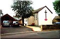
St Paul's church, Walton
An Anglican church built in 1967 to replace an earlier 'tin tabernacle' of 1897. Architect George Pace of York.
Image: © Stephen Craven
Taken: 31 Aug 2020
0.09 miles
10
Walton, St Paul's Church
This Church is slightly to the west of centre on the northern edge of the O/S grid which it occupies.
Image: © Bill Henderson
Taken: Unknown
0.09 miles