IMAGES TAKEN NEAR TO
Lime Crescent, WAKEFIELD, WF2 6RY
Introduction
This page details the photographs taken nearby to Lime Crescent, WF2 6RY by members of the Geograph project.
The Geograph project started in 2005 with the aim of publishing, organising and preserving representative images for every square kilometre of Great Britain, Ireland and the Isle of Man.

There are currently over 7.5m images from over14,400 individuals and you can help contribute to the project by visiting https://www.geograph.org.uk
Image Map
Images are licensed for reuse under creativecommons.org/licenses/by-sa/2.0
Notes
- Clicking on the map will re-center to the selected point.
- The higher the marker number, the further away the image location is from the centre of the postcode.
Image Listing (24 Images Found)
Images are licensed for reuse under creativecommons.org/licenses/by-sa/2.0
Image
Details
Distance
6
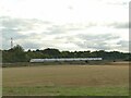
Northbound express at Walton
A 9-coach Azuma service approaching its next stop at Wakefield.
Image: © Stephen Craven
Taken: 10 Sep 2022
0.10 miles
7
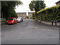
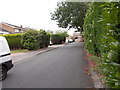
Marriott Grove - looking towards Walton Lane
Image: © Betty Longbottom
Taken: 24 Jul 2015
0.12 miles
8
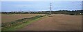
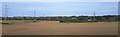
Pylon lines across fields east of Sandal
Image: © Christopher Hilton
Taken: 18 Oct 2023
0.16 miles
9
Pylon lines across fields east of Sandal
Image: © Christopher Hilton
Taken: 18 Oct 2023
0.17 miles
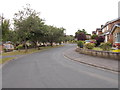
10
St Helen's Grove - looking towards Walton Lane
Image: © Betty Longbottom
Taken: 24 Jul 2015
0.18 miles