
IMAGES TAKEN NEAR TO
The Balk, WAKEFIELD, WF2 6QL
Introduction
This page details the photographs taken nearby to The Balk, WF2 6QL by members of the Geograph project.
The Geograph project started in 2005 with the aim of publishing, organising and preserving representative images for every square kilometre of Great Britain, Ireland and the Isle of Man.

There are currently over 7.5m images from over14,400 individuals and you can help contribute to the project by visiting https://www.geograph.org.uk
Image Map
Images are licensed for reuse under creativecommons.org/licenses/by-sa/2.0
Notes
- Clicking on the map will re-center to the selected point.
- The higher the marker number, the further away the image location is from the centre of the postcode.
Image Listing (34 Images Found)
Images are licensed for reuse under creativecommons.org/licenses/by-sa/2.0
Image
Details
Distance
1
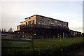
Waterton Park Golf Club clubhouse
The Trans Pennine Trail passes between the clubhouse and the golf course.
Image: © Graham Hogg
Taken: 30 Nov 2012
0.00 miles
2
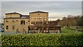
Waterton Park Golf Club
The clubhouse was so clean and tidy it could have been a model. With its own bridge across the long closed Barnsley Canal, and beside the Pennine Trail.
Image: © Chris Morgan
Taken: 30 Nov 2012
0.01 miles
3
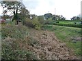
The Barnsley Canal, without water
Opened in 1799 to carry coal from Barnsley and grain from Wakefield. Looking south from the golf course footbridge.
Image: © Christine Johnstone
Taken: 4 Nov 2014
0.02 miles
4

Barnsley Canal Bridge at Walton Hall (late C17)
Image: © Stanley Walker
Taken: 16 Aug 2010
0.02 miles
6
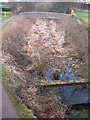
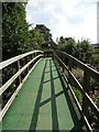
Northern end of the disused Barnsley Canal
See Image for information about the history of the canal.
The footbridge over the canal links the golf course to Waterton Park clubhouse.
Image: © Pauline E
Taken: 22 Mar 2010
0.02 miles
7
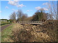
Golfers bridge over the disused Barnsley Canal
Image: © John Slater
Taken: 19 Feb 2012
0.03 miles
8
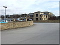
Waterton Park Golf Club
The clubhouse of Waterton Park Golf Club at Walton.
Image: © Ian Russell
Taken: 16 Mar 2007
0.03 miles
9
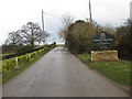
Narrow bridge ahead
Approaching the disused Barnsley Canal towards Waterton Park Hotel seems safer on foot than in a vehicle. It's single track and a blind spot until you are almost on the summit of the bridge.
Image: © Pauline E
Taken: 22 Mar 2010
0.03 miles
10
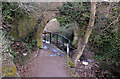
Barnsley Canal (disused)
The canalside footpath passes under the old stone bridge at this point. The canal is accumulating litter, presumably from passing walkers.
It was 16 miles long and had 20 locks and a junction near Barnsley with the Dearne and Dove Canal.
http://www.penninewaterways.co.uk/barnsley/ba2.htm
From the Pennine waterways website: "The Barnsley Canal was approved by Parliament in 1793. The section between Barnsley and the Aire and Calder Navigation near Wakefield opened in 1799, with the section from Barnsley to Barnby Basin opening three years later.
It was a broad canal with 15 locks between the River Calder and the main level at Walton. A further 5 locks took the canal up to Barnby Basin, with water needing to be back-pumped up this flight, as the company was not allowed to take water from the Dearne at Barnby. The main level was supplied from Wintersett and Cold Hiendley Reservoirs.
Half a mile east of Barnsley, the canal crossed the River Dearne on a high five arch aqueduct. On the south side of this aqueduct was the junction with the Dearne and Dove Canal, which opened in 1804 and ran to the River Don Navigation at Swinton.
The colliery at Barnby ran into difficulties fairly soon after the canal opened, but the company built a tramroad from Barnby Basin to Silkstone Colliery, which produced good quality coal, helping the canal to be very successful. Barnby Colliery later re-opened and other collieries close to the canal's route through Barnsley, Monk Bretton and Royston added to the prosperity.
As a result of competition from the new railway companies, the Barnsley Canal was leased and later bought by the Aire and Calder Navigation Company, which improved the waterway and enlarged the locks, with trade picking up again for a number of years. In 1893, the section of canal above Barugh Locks was closed as most of the trade here had been lost to the railways.
Although trade on the rest of the canal continued through to World War II, the canal suffered from constant subsidence problems due to mining, with the banks needing to be built up. Subsidence caused a spectacular breach at the southern end of Barnsley Aqueduct in 1911, which closed the canal for eight months. Another huge breach occurred at Littleworth in 1946 which directly led to the canal's closure in 1953. The company had decided that it would be cheaper to compensate the canal's users than to constantly repair the canal. Barnsley Aqueduct was demolished a year later, as it was showing large cracks and a sag due to mining subsidence.
One of the unusual features of the Barnsley Canal was the use of pulleys mounted on stone blocks on sharp bends, between the towpath and the canal edge. The idea was that as boats approached the corner, the tow rope would be fitted into the pulley. This would assist the steerer as it would prevent the horse from pulling the boat into the bank on the corner."
I include this here in case the website becomes defunct at some point.
Image: © Pauline E
Taken: 22 Mar 2010
0.03 miles