
IMAGES TAKEN NEAR TO
Manor Road, WAKEFIELD, WF2 6PB
Introduction
This page details the photographs taken nearby to Manor Road, WF2 6PB by members of the Geograph project.
The Geograph project started in 2005 with the aim of publishing, organising and preserving representative images for every square kilometre of Great Britain, Ireland and the Isle of Man.

There are currently over 7.5m images from over14,400 individuals and you can help contribute to the project by visiting https://www.geograph.org.uk
Image Map
Images are licensed for reuse under creativecommons.org/licenses/by-sa/2.0
Notes
- Clicking on the map will re-center to the selected point.
- The higher the marker number, the further away the image location is from the centre of the postcode.
Image Listing (46 Images Found)
Images are licensed for reuse under creativecommons.org/licenses/by-sa/2.0
Image
Details
Distance
1
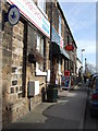
Walton Post Office
The Post Office on School Lane, Walton.
Image: © Ian Russell
Taken: 16 Mar 2007
0.01 miles
2
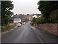
Manor Road - looking towards School Lane
Image: © Betty Longbottom
Taken: 8 Sep 2015
0.03 miles
3
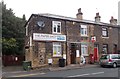
Post Office & Newsagents - School Lane
Image: © Betty Longbottom
Taken: 8 Sep 2015
0.03 miles
4
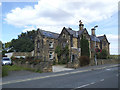
Former girls' school, School Lane, Walton
According to a local website https://overtown.org.uk/about-walton/history.html, this building dates from 1867, and was a Training, Laundry and Cooking School, "to prepare girls for service" It is now two semi-detached cottages, known as Manor House and Bridge House.
Image: © Stephen Craven
Taken: 31 Aug 2020
0.03 miles
5
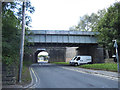
Eastern railway bridge, School Lane, Walton
Walton railway station (originally called Oakenshaw, later Sandal and Walton from 1870 to 1951) was off to the left here. It closed in 1961 and most of the site is now occupied by housing). The further of the two bridges is the older one, opened in 1840 by the North Midland Railway. It no longer carries any tracks. The second bridge is a steel one added some time in the 20th century, and still carries a freight line to a glassworks at Monk Bretton.
Image: © Stephen Craven
Taken: 31 Aug 2020
0.05 miles
7

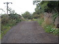
Bridges on School Lane, Walton
Railway bridges over School Lane, Walton. The bridges carried the Midland Railway main line from Leeds to London. The bridge nearest in the picture was added in later years when the line was quadrupled.
Image: © Ian Russell
Taken: 16 Mar 2007
0.05 miles
9

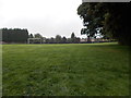
Western railway bridge, School Lane, Walton
Walton railway station (originally called Oakenshaw, later Sandal and Walton from 1870 to 1951) was off to the right here. It closed in 1961 and most of the site is now occupied by housing. The nearer of the two bridges, a brick arch with a clearance of 14ft, is the older one, opened in 1840 by the North Midland Railway. It no longer carries any tracks. The further bridge is a steel one added some time in the 20th century, and still carries a freight line to a glassworks at Monk Bretton.
Image: © Stephen Craven
Taken: 31 Aug 2020
0.06 miles
10
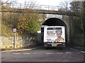
Single decker passing under School Lane bridge
The advert on the rear of the 195 reflects the current high price of some metals.
Image: © Pauline E
Taken: 4 Nov 2011
0.06 miles