IMAGES TAKEN NEAR TO
Oakenshaw Lane, WAKEFIELD, WF2 6NL
Introduction
This page details the photographs taken nearby to Oakenshaw Lane, WF2 6NL by members of the Geograph project.
The Geograph project started in 2005 with the aim of publishing, organising and preserving representative images for every square kilometre of Great Britain, Ireland and the Isle of Man.

There are currently over 7.5m images from over14,400 individuals and you can help contribute to the project by visiting https://www.geograph.org.uk
Image Map
Images are licensed for reuse under creativecommons.org/licenses/by-sa/2.0
Notes
- Clicking on the map will re-center to the selected point.
- The higher the marker number, the further away the image location is from the centre of the postcode.
Image Listing (37 Images Found)
Images are licensed for reuse under creativecommons.org/licenses/by-sa/2.0
Image
Details
Distance
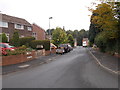
4
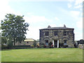
Elmwood Farm, Walton
The 18th century farmhouse, at one time called 'Walton Villas', is grade II listed (list entry 1313224). The stone barn behind and to the left is separately listed (entry 1135576).
Image: © Stephen Craven
Taken: 31 Aug 2020
0.09 miles
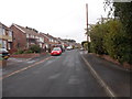
5
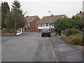
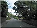
Manor Rise - viewed from Manor Crescent
Image: © Betty Longbottom
Taken: 8 Sep 2015
0.10 miles
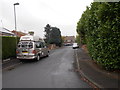
7
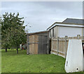
Walton Lane Trig Point Flush Bracket S4100
Image: © thejackrustles
Taken: 12 Oct 2021
0.10 miles
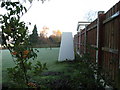
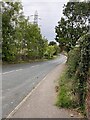
10
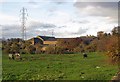
Elmwood Farm
View across the paddock from the junction of School Lane and Greenside.
Image: © Pauline E
Taken: 4 Nov 2011
0.12 miles