IMAGES TAKEN NEAR TO
Morrell Crescent, WAKEFIELD, WF2 0SU
Introduction
This page details the photographs taken nearby to Morrell Crescent, WF2 0SU by members of the Geograph project.
The Geograph project started in 2005 with the aim of publishing, organising and preserving representative images for every square kilometre of Great Britain, Ireland and the Isle of Man.

There are currently over 7.5m images from over14,400 individuals and you can help contribute to the project by visiting https://www.geograph.org.uk
Image Map
Images are licensed for reuse under creativecommons.org/licenses/by-sa/2.0
Notes
- Clicking on the map will re-center to the selected point.
- The higher the marker number, the further away the image location is from the centre of the postcode.
Image Listing (43 Images Found)
Images are licensed for reuse under creativecommons.org/licenses/by-sa/2.0
Image
Details
Distance
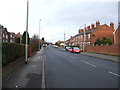
7
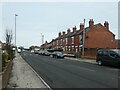
Terrace of houses, Potovens Lane
Each house is a little higher than the one before, but the roof is one continuous slope.
Image: © Christine Johnstone
Taken: 31 Jan 2021
0.07 miles
9
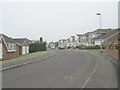
Patterson Court - looking towards Thompson Drive
Image: © Betty Longbottom
Taken: 22 Jul 2013
0.09 miles