
IMAGES TAKEN NEAR TO
Gawthorpe Lane, WAKEFIELD, WF2 0SR
Introduction
This page details the photographs taken nearby to Gawthorpe Lane, WF2 0SR by members of the Geograph project.
The Geograph project started in 2005 with the aim of publishing, organising and preserving representative images for every square kilometre of Great Britain, Ireland and the Isle of Man.

There are currently over 7.5m images from over14,400 individuals and you can help contribute to the project by visiting https://www.geograph.org.uk
Image Map
Images are licensed for reuse under creativecommons.org/licenses/by-sa/2.0
Notes
- Clicking on the map will re-center to the selected point.
- The higher the marker number, the further away the image location is from the centre of the postcode.
Image Listing (66 Images Found)
Images are licensed for reuse under creativecommons.org/licenses/by-sa/2.0
Image
Details
Distance
1
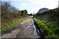
Gawthorpe Lanetowards Batley Road, Kirkhamgate
Image: © Ian S
Taken: 18 Apr 2018
0.01 miles
2
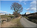
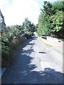
Gawthorpe Lane
Looking up towards Batley Road, Kirkhamgate. Gawthorpe Lane is an old highway, now classified as a bridleway. It is a useful cycling route.
Image: © Humphrey Bolton
Taken: 4 Mar 2010
0.03 miles
3
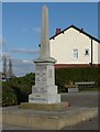
War memorial, Kirkhamgate
War memorial, Kirkhamgate - On the front: "To the glory of God and to the memory of the men who gave their lives for the cause of freedom in the Great War 1914 -1918 / 1914 T W Gill / 1915 J W Brook, J Ward, C Brook, J Auty, H Vickers / 1916 J Jowett, F Hartley, B Ward, C Hewitt, H Ramsden, S L Miller, F W Corby, C Mercer / 1917 C Hopewell, C Calvert, C Porthouse / 1918 C S Holroyd, L Jowett, W Milner, T Yates, C T Taylor, H Pickersgill, H S Cething, J H Ainsworth, C A Hartley, P Dickens, A Firth / Their names shall remain for ever, and their glory shall not be blotted out." On the side: "1939 - 1945 / J Broadhead, W Earnshaw, H Jowett, A Pierce, R Pierce, L Pickersgill, M D Pickersgill" I apologise if I have made any errors in the transcription.
Image: © Humphrey Bolton
Taken: 4 Mar 2010
0.07 miles
4
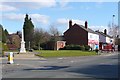
Junction of Brandy Carr Road and Batley Road, Kirkhamgate
This is the centre of the village of Kirkhamgate, which was part of the township of Alverthorpe. Here is the war memorial, a few shops and the bus stop.
Image: © Humphrey Bolton
Taken: 4 Mar 2010
0.07 miles
6
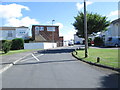
Greenlay Drive - looking towards Batley Road
Image: © Betty Longbottom
Taken: 3 Sep 2013
0.08 miles
9
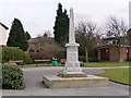
War memorial, Kirkhamgate
27 Kirkhamgate men died in the First World War.
Image: © Christine Johnstone
Taken: 17 Mar 2010
0.10 miles
10
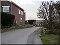
Drive to newer houses off Batley Road, Kirkhamgate
Image: © Christine Johnstone
Taken: 17 Mar 2010
0.10 miles