
IMAGES TAKEN NEAR TO
Carr Gate, WAKEFIELD, WF2 0QD
Introduction
This page details the photographs taken nearby to WF2 0QD by members of the Geograph project.
The Geograph project started in 2005 with the aim of publishing, organising and preserving representative images for every square kilometre of Great Britain, Ireland and the Isle of Man.

There are currently over 7.5m images from over14,400 individuals and you can help contribute to the project by visiting https://www.geograph.org.uk
Image Map
Images are licensed for reuse under creativecommons.org/licenses/by-sa/2.0
Notes
- Clicking on the map will re-center to the selected point.
- The higher the marker number, the further away the image location is from the centre of the postcode.
Image Listing (15 Images Found)
Images are licensed for reuse under creativecommons.org/licenses/by-sa/2.0
Image
Details
Distance
1
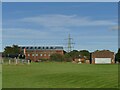
West Yorkshire Police training centre
The buildings are viewed here from the public footpath along the western side of the site.
Image: © Stephen Craven
Taken: 15 Oct 2023
0.01 miles
2
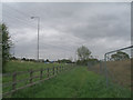
Footpath approaching the M1 near Junction 41
Major construction work is going on behind the earth mound to the right
Image: © John Slater
Taken: 12 May 2013
0.09 miles
3
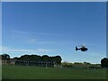
Police helicopter taking off
The West Yorkshire Police training facility near Wrenthorpe is also the base for some of the aircraft of the National Police Air Service.
Image: © Stephen Craven
Taken: 15 Oct 2023
0.11 miles
4
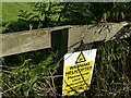
Police helicopter warning
A classic 'duck or grouse' type warning, see Image
Image: © Stephen Craven
Taken: 15 Oct 2023
0.12 miles
5
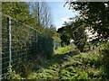
Diverted footpath
This footpath has been diverted from the route shown on my printed Explorer map (2013 edition). It now runs round three sides of the West Yorkshire Police training centre (to the left, behind the security fence and trees). The date of the map, and John Slater's 2013 view of the section round the north side of the site, give this as a rough date for its construction Image
Image: © Stephen Craven
Taken: 15 Oct 2023
0.13 miles
6
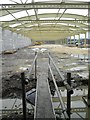
New police building under construction
Image: © Steve Fareham
Taken: 27 Nov 2012
0.15 miles
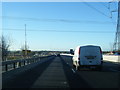
8
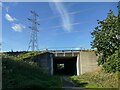
M1 underpass
This subway is longer than most, at about 60 metres, as it carries not only the main carriageway but also slip roads to Junction 41.
Image: © Stephen Craven
Taken: 15 Oct 2023
0.16 miles
9
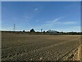
Field south of the M1
A recently ploughed and tilled field.
Image: © Stephen Craven
Taken: 15 Oct 2023
0.16 miles
10
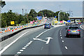
Northbound M1, Exit Sliproad at Junction 41
Image: © David Dixon
Taken: 8 Aug 2015
0.17 miles