
IMAGES TAKEN NEAR TO
Rhubarb Hill, WAKEFIELD, WF2 0GP
Introduction
This page details the photographs taken nearby to Rhubarb Hill, WF2 0GP by members of the Geograph project.
The Geograph project started in 2005 with the aim of publishing, organising and preserving representative images for every square kilometre of Great Britain, Ireland and the Isle of Man.

There are currently over 7.5m images from over14,400 individuals and you can help contribute to the project by visiting https://www.geograph.org.uk
Image Map
Images are licensed for reuse under creativecommons.org/licenses/by-sa/2.0
Notes
- Clicking on the map will re-center to the selected point.
- The higher the marker number, the further away the image location is from the centre of the postcode.
Image Listing (54 Images Found)
Images are licensed for reuse under creativecommons.org/licenses/by-sa/2.0
Image
Details
Distance
1
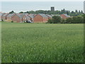
Lindale Park and Alverthorpe church
Persimmon's new estate on the western edge of Alverthorpe.
Image: © Christine Johnstone
Taken: 9 Jun 2020
0.05 miles
2
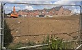
Houses on Rhubarb Hill, Lindale Park
Part of a Persimmon Homes' development at the western edge of Alverthorpe.
Image: © Christine Johnstone
Taken: 5 Jun 2020
0.06 miles
3
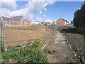
Open space under the power lines, Lindale Park
Persimmon Homes' new development at the western edge of Alverthorpe.
Image: © Christine Johnstone
Taken: 5 Jun 2020
0.08 miles
5
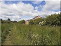
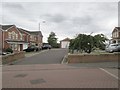
Public footpath below houses on Rhubarb Hill
'Rhubarb Hill' is a street name on the Lindale Park development on the western edge of Alverthorpe.
Image: © Christine Johnstone
Taken: 5 Jun 2020
0.09 miles
6
Geary Drive - viewed from Billingham Close
Image: © Betty Longbottom
Taken: 10 Sep 2013
0.09 miles
8
Geary Drive - viewed from Billingham Close
Image: © Betty Longbottom
Taken: 10 Sep 2013
0.10 miles
9
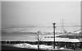
Rhubarb fields, Alverthorpe, winter 1959
The nearer fields (from the road down to the hedge in the middle distance) were planted with rhubarb. The low sheds on the right of the picture were the darkened sheds in which the young rhubarb was forced. The road in the foreground is the main road between Wakefield and Batley.
Image: © Euchiasmus
Taken: Unknown
0.11 miles
10
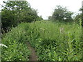
Informal path on the north bank of Alverthorpe Beck
Not a public footpath, but well-used.
Image: © Christine Johnstone
Taken: 9 Jun 2020
0.12 miles