
IMAGES TAKEN NEAR TO
Canning Avenue, WAKEFIELD, WF2 0BN
Introduction
This page details the photographs taken nearby to Canning Avenue, WF2 0BN by members of the Geograph project.
The Geograph project started in 2005 with the aim of publishing, organising and preserving representative images for every square kilometre of Great Britain, Ireland and the Isle of Man.

There are currently over 7.5m images from over14,400 individuals and you can help contribute to the project by visiting https://www.geograph.org.uk
Image Map
Images are licensed for reuse under creativecommons.org/licenses/by-sa/2.0
Notes
- Clicking on the map will re-center to the selected point.
- The higher the marker number, the further away the image location is from the centre of the postcode.
Image Listing (85 Images Found)
Images are licensed for reuse under creativecommons.org/licenses/by-sa/2.0
Image
Details
Distance
1
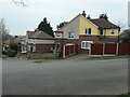
Canning Avenue stepping down the hillside
Wakefield Council built this small housing estate in the 1920s.
Image: © Christine Johnstone
Taken: 21 Mar 2022
0.02 miles
2

Canning Avenue - viewed from Pacaholme Road
Image: © Betty Longbottom
Taken: 10 Sep 2013
0.02 miles
3

Marion Avenue - viewed from Pacaholme Road
Image: © Betty Longbottom
Taken: 10 Sep 2013
0.04 miles

5
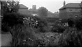
Alverthorpe council houses and St Paul's Church tower, 1959
The house on the right is on the corner of Batley Road and Pacaholme Road. The other houses, which are seen from the back, are along Marion Avenue. The square tower of St Paul's Church can be seen in the distance.
Image: © Euchiasmus
Taken: Unknown
0.05 miles


8
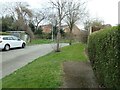
Never the twain shall meet, Alverthorpe
In the foreground, the end of Childs Road, part of a small estate built by Wakefield Council in the 1920s. In the background, houses on Harewood Drive, part of a private infill development built in the 1990s. There is no direct connection between the two roads.
Image: © Christine Johnstone
Taken: 21 Mar 2022
0.06 miles
9
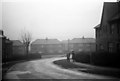
Council houses in Alverthorpe, 1959
Photograph taken looking down Marion Avenue. This was a council estate north of the road between Wakefield and Batley. This housing estate is still standing and occupied, as can be seen on http://www.flashearth.com/?lat=53.692199&lon=-1.534396&z=19.4&r=0&src=ggl
Image: © Euchiasmus
Taken: Unknown
0.08 miles
10
Childs Road - viewed from Marion Avenue
Image: © Betty Longbottom
Taken: 10 Sep 2013
0.09 miles