IMAGES TAKEN NEAR TO
Thomas Street, BATLEY, WF17 8PR
Introduction
This page details the photographs taken nearby to Thomas Street, WF17 8PR by members of the Geograph project.
The Geograph project started in 2005 with the aim of publishing, organising and preserving representative images for every square kilometre of Great Britain, Ireland and the Isle of Man.

There are currently over 7.5m images from over14,400 individuals and you can help contribute to the project by visiting https://www.geograph.org.uk
Image Map
Images are licensed for reuse under creativecommons.org/licenses/by-sa/2.0
Notes
- Clicking on the map will re-center to the selected point.
- The higher the marker number, the further away the image location is from the centre of the postcode.
Image Listing (158 Images Found)
Images are licensed for reuse under creativecommons.org/licenses/by-sa/2.0
Image
Details
Distance
1
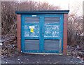
Electricity Substation No 7348 - Thomas Street
Image: © Betty Longbottom
Taken: 11 Dec 2012
0.05 miles
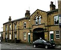
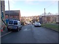
4

St Mary's Social Club - viewed from Thomas Street
Image: © Betty Longbottom
Taken: 11 Dec 2012
0.07 miles
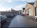
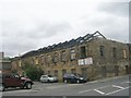
5
Carlinghow Mills - Bradford Road
Built 1877 - now converted into small business units.
Image: © Betty Longbottom
Taken: 6 Jul 2007
0.08 miles
7
Fire damaged property - Bradford Road
Image: © Betty Longbottom
Taken: 29 Jul 2011
0.09 miles
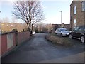
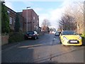
9
Cross Bank Road - viewed from Melton Street
Image: © Betty Longbottom
Taken: 11 Dec 2012
0.10 miles
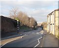
10
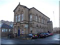
Former Wesleyan Sunday School - Blakeridge Lane
Enlarged 1882
Image: © Betty Longbottom
Taken: 11 Dec 2012
0.10 miles