IMAGES TAKEN NEAR TO
France Street, BATLEY, WF17 6NU
Introduction
This page details the photographs taken nearby to France Street, WF17 6NU by members of the Geograph project.
The Geograph project started in 2005 with the aim of publishing, organising and preserving representative images for every square kilometre of Great Britain, Ireland and the Isle of Man.

There are currently over 7.5m images from over14,400 individuals and you can help contribute to the project by visiting https://www.geograph.org.uk
Image Map
Images are licensed for reuse under creativecommons.org/licenses/by-sa/2.0
Notes
- Clicking on the map will re-center to the selected point.
- The higher the marker number, the further away the image location is from the centre of the postcode.
Image Listing (120 Images Found)
Images are licensed for reuse under creativecommons.org/licenses/by-sa/2.0
Image
Details
Distance
1
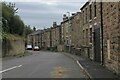
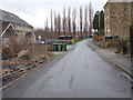
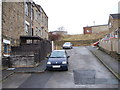
Oaks Road, Batley
Residential area of Batley, leading onto Fort Ann Road
Image: © Chris Heaton
Taken: 3 Sep 2024
0.02 miles
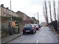
3
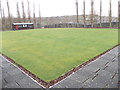
Soothill Bowling Club - France Street
Image: © Betty Longbottom
Taken: 18 Dec 2012
0.05 miles
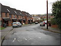
6
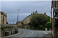
Soothill Lane
Suburban scene in Batley, depicting the B6124 climbing eastwards away from the town centre
Image: © Chris Heaton
Taken: 3 Sep 2024
0.05 miles
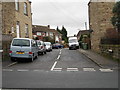
8
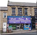
Money Wise Mini Market - Soothill Lane
Image: © Betty Longbottom
Taken: 2 Jan 2013
0.05 miles
10
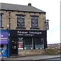
New Image Hair Design - Soothill Lane
Image: © Betty Longbottom
Taken: 2 Jan 2013
0.06 miles