IMAGES TAKEN NEAR TO
Batley Field Hill, BATLEY, WF17 0BG
Introduction
This page details the photographs taken nearby to Batley Field Hill, WF17 0BG by members of the Geograph project.
The Geograph project started in 2005 with the aim of publishing, organising and preserving representative images for every square kilometre of Great Britain, Ireland and the Isle of Man.

There are currently over 7.5m images from over14,400 individuals and you can help contribute to the project by visiting https://www.geograph.org.uk
Image Map
Images are licensed for reuse under creativecommons.org/licenses/by-sa/2.0
Notes
- Clicking on the map will re-center to the selected point.
- The higher the marker number, the further away the image location is from the centre of the postcode.
Image Listing (63 Images Found)
Images are licensed for reuse under creativecommons.org/licenses/by-sa/2.0
Image
Details
Distance
1
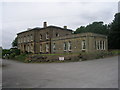
Blenheim House - Batley Field Hill
This was originally built for a Victorian mill owner, Joseph Jubb, and his wife Hannah.
It is now used as a venue for weddings, parties etc.
Image: © Betty Longbottom
Taken: 29 Jul 2011
0.01 miles
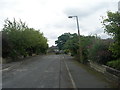
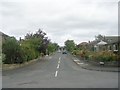
2
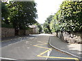
Blenheim Drive - Batley Field Hill
Image: © Betty Longbottom
Taken: 29 Jul 2011
0.02 miles
3
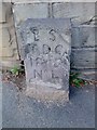
Old Boundary Marker by the B6123, Batley Field Hill, Lamplands
Parish Boundary Marker in parish of Batley and Liversedge (Calderdale District), Batley Field Hill, 350 metres from junction with A652 Bradford Road.
Inscription reads:-
B S
TDC
1869
N⁰ 4
Grade II listed.
List Entry Number: 1271725 https://historicengland.org.uk/listing/the-list/list-entry/1271725
Surveyed
Milestone Society National ID: YW_BAT04pb
Image: © Milestone Society
Taken: Unknown
0.03 miles
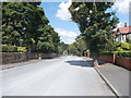
4
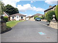
Batley Field Hill - viewed from Blenheim Drive
Image: © Betty Longbottom
Taken: 8 Aug 2012
0.04 miles
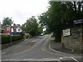
6
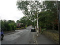
York Road - viewed from York Court
Image: © Betty Longbottom
Taken: 29 Jul 2011
0.06 miles
8
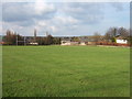
Playing Fields, Upper Batley
This is a playing field used by Batley Business & Enterprise College (formerly Batley Boys High School) which can be walked around using the public footpath from Blenheim Drive to The Balk.
In the distance on the edge of the field are houses at the top of Batley Field Hill and Heaton Road.
Image: © Gary Hughes
Taken: 21 Apr 2008
0.10 miles