IMAGES TAKEN NEAR TO
Smithies Lane, HECKMONDWIKE, WF16 0PN
Introduction
This page details the photographs taken nearby to Smithies Lane, WF16 0PN by members of the Geograph project.
The Geograph project started in 2005 with the aim of publishing, organising and preserving representative images for every square kilometre of Great Britain, Ireland and the Isle of Man.

There are currently over 7.5m images from over14,400 individuals and you can help contribute to the project by visiting https://www.geograph.org.uk
Image Map
Images are licensed for reuse under creativecommons.org/licenses/by-sa/2.0
Notes
- Clicking on the map will re-center to the selected point.
- The higher the marker number, the further away the image location is from the centre of the postcode.
Image Listing (19 Images Found)
Images are licensed for reuse under creativecommons.org/licenses/by-sa/2.0
Image
Details
Distance
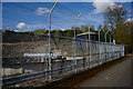
2
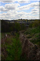
River Spen south of Heckmondwike
I had been following the "Spen Valley Greenway" for several miles before getting the first glimpse of the eponymous river - just in front of the trees in this view. Beyond the river is the Heckmondwike sewage works.
Image: © Stephen Craven
Taken: 17 Jun 2017
0.09 miles
3
The arcs, Spen Valley Greenway, Heckmondwike
If cyclists are bored with the easy route up and down the greenway, they can try these narrow arcs, one in cutting and one high up.
Image: © Humphrey Bolton
Taken: 19 Oct 2006
0.10 miles
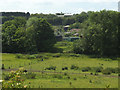
4
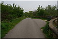
Fields near Park Farm
Looking across fields used for grazing horses from the Spen Valley Greenway.
Image: © DS Pugh
Taken: 25 Feb 2023
0.10 miles
5
Path running east from Lodge Lane, Heckmondwike
Image: © habiloid
Taken: 18 Apr 2017
0.14 miles
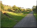
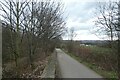
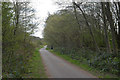
7
Remains of a bridge
At this point the Spen Valley Greenway is not following the exact route of the railway line, which was to the right of the photo; the curved walls here were the abutment of a bridge carrying a works access track over the line.
Image: © Stephen Craven
Taken: 17 Jun 2017
0.14 miles
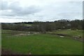
8
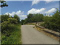
Descent on the greenway
Forming part of National Cycle Network Route 66, the Spen Valley Greenway runs between Bradford and Dewsbury. From here the two masts at Emley Moor could easily be seen in the distance.
Image: © DS Pugh
Taken: 25 Feb 2023
0.15 miles
10
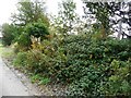
Evidence of former use
Railway half mile post in the verge alongside the Spen Valley Greenway.
Image: © Christine Johnstone
Taken: 5 Oct 2010
0.18 miles