
IMAGES TAKEN NEAR TO
Thornes Lane, WAKEFIELD, WF1 5RR
Introduction
This page details the photographs taken nearby to Thornes Lane, WF1 5RR by members of the Geograph project.
The Geograph project started in 2005 with the aim of publishing, organising and preserving representative images for every square kilometre of Great Britain, Ireland and the Isle of Man.

There are currently over 7.5m images from over14,400 individuals and you can help contribute to the project by visiting https://www.geograph.org.uk
Image Map
Images are licensed for reuse under creativecommons.org/licenses/by-sa/2.0
Notes
- Clicking on the map will re-center to the selected point.
- The higher the marker number, the further away the image location is from the centre of the postcode.
Image Listing (418 Images Found)
Images are licensed for reuse under creativecommons.org/licenses/by-sa/2.0
Image
Details
Distance
1

New Brunswick Street, Wakefield
Looking towards Russell Street and Image]
Image: © Rich Tea
Taken: 19 Jun 2006
0.03 miles
2
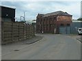
T F James Ltd, New Brunswick Street, Wakefield
This derelict factory was built between 1905 and 1913, on what was then Back New Brunswick Street.
Image: © Christine Johnstone
Taken: 12 May 2020
0.05 miles

4

Skip hire yard, New Brunswick St, Wakefield
The yard of Pick Up Skips.
Image: © Rich Tea
Taken: 19 Jun 2006
0.05 miles

6

New Brunswick Street - Thornes Lane Wharf
Image: © Betty Longbottom
Taken: 23 Mar 2009
0.05 miles
7
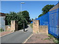
Looking west along Smithson's Tramroad, Wakefield
Or at least the route of it. Smithson's Tramroad brought coal down from Low Laithes to Thornes Wharf, just ahead on the River Calder. The horse-drawn railway opened in 1798 and had L section rails on stone sleepers. It was still operating in 1850, but by the late 1880s mining had ceased at the old Low Laithes sites. A stub of the tramroad still operated in the late 1880s, from a quarry near Denby Dale Road to sidings below the Kirkgate railway line. By 1904-07 even this stub had gone. This section [from Waldorf Way to New Brunswick Street] is now a public footpath.
Image: © Christine Johnstone
Taken: 28 May 2020
0.06 miles
8

Smithson's Tramroad, east of the L & Y railway, Wakefield
Smithson's Tramroad brought coal down from Low Laithes to Thornes Wharf, just ahead on the River Calder. The horse-drawn railway opened in 1798 and had L section rails on stone sleepers. It was still operating in 1850, but by the late 1880s mining had ceased at the old Low Laithes sites. A stub of the tramroad still operated in the late 1880s, from a quarry near Denby Dale Road to sidings below the Kirkgate railway line, just to the left / east. By 1904-07 even this stub had gone. This section [from Waldorf Way to New Brunswick Street] is now a public footpath.
Image: © Christine Johnstone
Taken: 28 May 2020
0.06 miles

