
IMAGES TAKEN NEAR TO
Staithes Road, WAKEFIELD, WF1 5FR
Introduction
This page details the photographs taken nearby to Staithes Road, WF1 5FR by members of the Geograph project.
The Geograph project started in 2005 with the aim of publishing, organising and preserving representative images for every square kilometre of Great Britain, Ireland and the Isle of Man.

There are currently over 7.5m images from over14,400 individuals and you can help contribute to the project by visiting https://www.geograph.org.uk
Image Map
Images are licensed for reuse under creativecommons.org/licenses/by-sa/2.0
Notes
- Clicking on the map will re-center to the selected point.
- The higher the marker number, the further away the image location is from the centre of the postcode.
Image Listing (62 Images Found)
Images are licensed for reuse under creativecommons.org/licenses/by-sa/2.0
Image
Details
Distance
1

Redevelopment Site
Waste ground, with piles of crushed rock waiting to be used for something.
Image: © Anne Burgess
Taken: 1 Jul 2018
0.10 miles

3

New homes built by Avant, off Neil Fox Way
Part of the massive City Fields development, on Wakefield's eastern edge.
Image: © Christine Johnstone
Taken: 5 May 2020
0.10 miles
4

Engine & brake on Knottingley line passing Wakefield Locomotive Depot
View SE, towards Crofton Junction, Pontefract and Knottingley, also Doncaster etc. by the West Riding & Grimsby line. The locomotive is one of numerous ex-WD 'Austerity' 2-8-0s which dominated the coal traffic in the area in the 1950s. No. 90348 was built as No. 7271 (later 77271) in 12/43, but did not work in Britain and was stored at Longmoor before going to the Continent in 11/44: it was returned in 6/46 and stored at Staveley LNE then put to work in 5/47 at Newport (Tees-side): after Nationalisation, as No. 90348 from 1/49 it worked on the LMR, surviving until 9/67.
Image: © Ben Brooksbank
Taken: 29 Jul 1966
0.11 miles
5
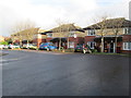
Buckingham Court - off Buckingham Drive
Image: © Betty Longbottom
Taken: 20 Dec 2014
0.14 miles
6

Oakenshaw Beck
Crossing the former Wakefield power station site, just before it joins the River Calder.
Image: © Christine Johnstone
Taken: 21 May 2017
0.15 miles
7

Land near Neil Fox Way
Looking towards new houses constructed beyond.
Image: © DS Pugh
Taken: 25 Feb 2023
0.16 miles
8

Redevelopment Site
Piles of crished rock obviously waiting to be used for construction.
Image: © Anne Burgess
Taken: 1 Jul 2018
0.16 miles
9

Eastern relief road construction
Looking towards construction being undertaken to build a new relief road on the eastern side of Wakefield.
Image: © DS Pugh
Taken: 1 Jul 2018
0.16 miles
10

Oakenshaw Beck
Looking along Oakenshaw Beck close to its confluence with the River Calder.
Image: © DS Pugh
Taken: 25 Feb 2023
0.17 miles