
IMAGES TAKEN NEAR TO
Norton Street, WAKEFIELD, WF1 5ES
Introduction
This page details the photographs taken nearby to Norton Street, WF1 5ES by members of the Geograph project.
The Geograph project started in 2005 with the aim of publishing, organising and preserving representative images for every square kilometre of Great Britain, Ireland and the Isle of Man.

There are currently over 7.5m images from over14,400 individuals and you can help contribute to the project by visiting https://www.geograph.org.uk
Image Map
Images are licensed for reuse under creativecommons.org/licenses/by-sa/2.0
Notes
- Clicking on the map will re-center to the selected point.
- The higher the marker number, the further away the image location is from the centre of the postcode.
Image Listing (140 Images Found)
Images are licensed for reuse under creativecommons.org/licenses/by-sa/2.0
Image
Details
Distance
1
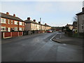
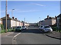
Norton Street - viewed from Sycamore Street
Image: © Betty Longbottom
Taken: 20 Dec 2014
0.01 miles
2
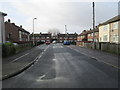
Norton Street - viewed from Sycamore Street
Image: © Betty Longbottom
Taken: 20 Dec 2014
0.03 miles
5
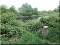
Repurposed mooring post, south bank of the Calder
Now used as a bird table. On the north bank is the remains of a conveyor chute, for loading coal [I think] into boats.
Image: © Christine Johnstone
Taken: 5 May 2020
0.05 miles
7
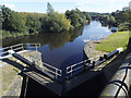
View downstream from Fall Ing lock
The lock is the point at which a short section of the Calder & Hebble Navigation rejoins the river Calder. Along with the basin immediately upstream it was built c. 1780 by engineer John Smeaton and is listed grade II (List entry 1242958).
Image: © Stephen Craven
Taken: 31 Aug 2020
0.06 miles
8
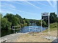
Welcome to the Aire & Calder Navigation
The junction with the Hebble & Calder Navigation at the head of the Wakefield (River Calder) branch.
Image: © Alan Murray-Rust
Taken: 1 Jul 2018
0.06 miles
9
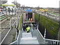
Temporary staircase into Fall Ing lock, Wakefield
The Canal & River Trust has been fitting new gates at Fall Ing lock. On 6th March 2016, a few days before re-opening the lock, it invited people to come and have a look. This is the easternmost lock on the Calder & Hebble Navigation. Despite what the OS map says, it is Fall Ing, not Fall Ings. 'Ing' is a local word for a riverside area that floods. The lock is 120 ft long, 17 ft 6 ins wide and raises the water level normally by 9 ft 3 ins [approx 37m, 5.4m and 2.8m].
Image: © Christine Johnstone
Taken: 6 Mar 2016
0.06 miles
10
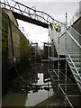
Fall Ing lock, drained
The Canal & River Trust has been fitting new gates at Fall Ing lock. On 6th March 2016, a few days before re-opening the lock, it invited people to come and have a look. This is the easternmost lock on the Calder & Hebble Navigation. Despite what the OS map says, it is Fall Ing, not Fall Ings. 'Ing' is a local word for a riverside area that floods. The lock is 120 ft long, 17 ft 6 ins wide and raises the water level normally by 9 ft 3 ins [approx 30m, 5.2m and 2.8m].
Image: © Christine Johnstone
Taken: 6 Mar 2016
0.06 miles