
IMAGES TAKEN NEAR TO
Church Lane, LIVERSEDGE, WF15 8ET
Introduction
This page details the photographs taken nearby to Church Lane, WF15 8ET by members of the Geograph project.
The Geograph project started in 2005 with the aim of publishing, organising and preserving representative images for every square kilometre of Great Britain, Ireland and the Isle of Man.

There are currently over 7.5m images from over14,400 individuals and you can help contribute to the project by visiting https://www.geograph.org.uk
Image Map
Images are licensed for reuse under creativecommons.org/licenses/by-sa/2.0
Notes
- Clicking on the map will re-center to the selected point.
- The higher the marker number, the further away the image location is from the centre of the postcode.
Image Listing (92 Images Found)
Images are licensed for reuse under creativecommons.org/licenses/by-sa/2.0
Image
Details
Distance
1

Stone Stile , Church Lane , Hartshead
Image: © Bill Henderson
Taken: 15 May 2009
0.04 miles
2

Footpath crossing crop field near Church Field Farm
Looking south-eastward.
Image: © Peter Wood
Taken: 25 Jul 2018
0.05 miles

4
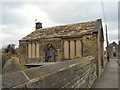
Hartshead Tithe Barn
The tithe barn at Hartshead church was originally built in 1351/52.
Image: © Gerald England
Taken: 7 Feb 2011
0.06 miles
5

Monuments on the east side of St Peter's Church, Hartshead
The small building was a school, built in 1822.
Image: © Humphrey Bolton
Taken: 11 Aug 2023
0.06 miles
6

Church Lane, Hartshead
Stocks, a rubbish bin, a horse-mounting platform and the start of the path to Beggarington can all be seen here.
Image: © habiloid
Taken: 10 Apr 2020
0.06 miles
7

Ordnance Survey Cut Mark
This mark can be found on the wall of St Peter's Church, Hartshead. The benchmark is calculated as being 151.7203 metres above sea level.
For more detail see : https://www.bench-marks.org.uk/bm54398
Image: © Peter Wood
Taken: 25 Jul 2018
0.06 miles
8

Hartshead Church Clock
The clock in the tower of Hartshead Church was installed in 1912.
Image: © Gerald England
Taken: 7 Feb 2011
0.06 miles
9

Hartshead Church
Showing the North side of the church. The original Hartshead Church is believed to have been built before 1120. A new church was built in 1662 which lasted until 1880 when the present church replaced it. The architect was W S Barber of Halifax. (information from "A short history of Hartshead Church" by Mabel Ferrett who herself was buried at Hartshead in 2011)
Image: © Gerald England
Taken: 7 Feb 2011
0.06 miles
10

Windy Bank
Fields off Windy Bank Lane.
Image: © Gerald England
Taken: 7 Feb 2011
0.06 miles