
IMAGES TAKEN NEAR TO
Chaloner Grove, WAKEFIELD, WF1 4ST
Introduction
This page details the photographs taken nearby to Chaloner Grove, WF1 4ST by members of the Geograph project.
The Geograph project started in 2005 with the aim of publishing, organising and preserving representative images for every square kilometre of Great Britain, Ireland and the Isle of Man.

There are currently over 7.5m images from over14,400 individuals and you can help contribute to the project by visiting https://www.geograph.org.uk
Image Map
Images are licensed for reuse under creativecommons.org/licenses/by-sa/2.0
Notes
- Clicking on the map will re-center to the selected point.
- The higher the marker number, the further away the image location is from the centre of the postcode.
Image Listing (141 Images Found)
Images are licensed for reuse under creativecommons.org/licenses/by-sa/2.0
Image
Details
Distance
1

Theatre date stone
Dated 1859, the theatre is now home to the Destiny church. See Image
Image: © Mike Kirby
Taken: 11 Mar 2009
0.01 miles
2
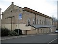
Destiny Christian Church
Destiny purchased their new building in October 2006 – formerly the Stanley Royd hospital dining hall, later a recreation hall and theatre. The former theatre, which dates back to 1859, is a grade II listed building. It houses one of only two existing Victorian stages in the UK.
Image: © Mike Kirby
Taken: 11 Mar 2009
0.03 miles
3
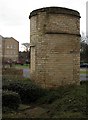
Former ventilating tower
This ventilating tower, part of the Paupers' Lunatic Asylum,(later Stanley Royd Hospital), is a grade II listed structure dated 1818. Built in white brick, cold air was drawn through this tower into the asylum.
Image: © Mike Kirby
Taken: 11 Mar 2009
0.03 miles
4
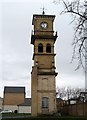
Clock tower, east face
The clock tower is all that survives of the administration block at the former Stanley Royd Hospital. The hospital buildings have now been converted into blocks of luxury apartments. The site is now called Parklands Manor.
Image: © Mike Kirby
Taken: 11 Mar 2009
0.04 miles
5

Beven Grove
One of several residential apartment blocks constructed in the grounds of Pinderfields Hospital.
Image: © James Allan
Taken: 31 Mar 2008
0.04 miles
6

Parklands ruin, Wakefield
The former grounds of the West Riding Pauper Lunatic Asylum [later Stanley Royd Hospital]. The housing development on the site is called Parklands. The building is not on any OS map I can find, but may have been a changing room, as it is next to a sports pitch.
Image: © Christine Johnstone
Taken: 5 May 2020
0.04 miles
7
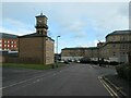
Old and new, Tuke Grove, Wakefield
The clock tower and the larger block of flats were originally part of the West Riding Pauper Lunatic Asylum [later Stanley Royd Hospital, now Parklands]. The small block of flats was built as part of the Parklands development and the larger red brick building is part of the PFI Pinderfields Hospital.
Image: © Christine Johnstone
Taken: 18 Feb 2021
0.05 miles
8
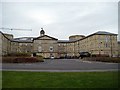
Parklands Manor
The main H block of the former Stanley Royd hospital. An east and west wing were added at a later date. These buildings have been converted into luxury apartments, and the site is now known as Parklands Manor.
Image: © Mike Kirby
Taken: 11 Mar 2009
0.05 miles
9

Weather vane & tower
Sat atop what was the main block of the former Stanley Royd Hospital, now Parklands Manor.
Image: © Mike Kirby
Taken: 11 Mar 2009
0.05 miles
10
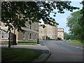
Blocks of the former Stanley Royd Mental Hospital, Wakefield, now housing.
Image: © Bill Henderson
Taken: 8 Jun 2007
0.06 miles