
IMAGES TAKEN NEAR TO
John Street, WAKEFIELD, WF1 4PN
Introduction
This page details the photographs taken nearby to John Street, WF1 4PN by members of the Geograph project.
The Geograph project started in 2005 with the aim of publishing, organising and preserving representative images for every square kilometre of Great Britain, Ireland and the Isle of Man.

There are currently over 7.5m images from over14,400 individuals and you can help contribute to the project by visiting https://www.geograph.org.uk
Image Map
Images are licensed for reuse under creativecommons.org/licenses/by-sa/2.0
Notes
- Clicking on the map will re-center to the selected point.
- The higher the marker number, the further away the image location is from the centre of the postcode.
Image Listing (323 Images Found)
Images are licensed for reuse under creativecommons.org/licenses/by-sa/2.0
Image
Details
Distance
1
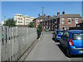
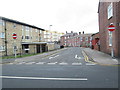
City centre housing, Wakefield
Two-storey terraced houses on John Street. Three-storey houses converted to at least 12 studios and flats on Peterson Road. High-rise flats on Kirkgate, above the Ridings shopping mall.
Image: © Christine Johnstone
Taken: 28 May 2020
0.01 miles
2
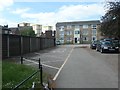
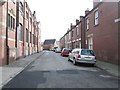
Blocks of flats, Wakefield
There are only eight high-rise blocks of flats in Wakefield city [population about 80,000]. The highest four are on top of the Ridings shopping mall and three of them can be seen in the distance. There are dozens of three-storey walk-up blocks of flats, like these off Brunswick Street.
Image: © Christine Johnstone
Taken: 5 May 2020
0.01 miles
7
![Chantry House is coming down [2]](https://s2.geograph.org.uk/geophotos/06/47/20/6472086_45cffea6_120x120.jpg)
Chantry House is coming down [2]
These offices were built in the 1970s for the West Yorkshire county council, and latterly were occupied by Wakefield Council and Groundwork Trust. They struggled to meet modern energy efficiency standards, being hot in summer and cold in winter, and are now [May 2020] being demolished.
Image: © Christine Johnstone
Taken: 5 May 2020
0.04 miles
9
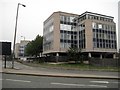
Chantry House
This disused council building is earmarked for demolition as part of the Kirkgate regeneration scheme.
Image: © Mike Kirby
Taken: 31 Aug 2008
0.05 miles
10
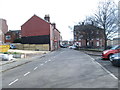
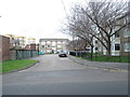
Hardy Croft - looking towards Peterson Road
Image: © Betty Longbottom
Taken: 4 Mar 2014
0.05 miles