IMAGES TAKEN NEAR TO
Woodhouse Road, WAKEFIELD, WF1 4NH
Introduction
This page details the photographs taken nearby to Woodhouse Road, WF1 4NH by members of the Geograph project.
The Geograph project started in 2005 with the aim of publishing, organising and preserving representative images for every square kilometre of Great Britain, Ireland and the Isle of Man.

There are currently over 7.5m images from over14,400 individuals and you can help contribute to the project by visiting https://www.geograph.org.uk
Image Map
Images are licensed for reuse under creativecommons.org/licenses/by-sa/2.0
Notes
- Clicking on the map will re-center to the selected point.
- The higher the marker number, the further away the image location is from the centre of the postcode.
Image Listing (124 Images Found)
Images are licensed for reuse under creativecommons.org/licenses/by-sa/2.0
Image
Details
Distance
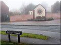
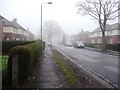
2
Junction of Shepley Street and Stanley Street, Eastmoor
Image: © Christine Johnstone
Taken: 19 Jan 2010
0.04 miles

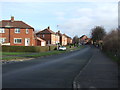
5
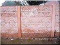
Wall of sunflowers, between Shepley Street and Stanley Street
Image: © Christine Johnstone
Taken: 19 Jan 2010
0.05 miles
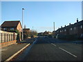
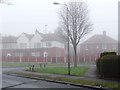
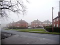
7
Junction of Woodhouse Road and Park Lodge Lane
Image: © Christine Johnstone
Taken: 19 Jan 2010
0.05 miles
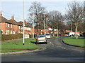
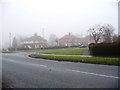
10
Park Lodge Crescent, from junction of Park Lodge Lane and Green Park
Image: © Christine Johnstone
Taken: 19 Jan 2010
0.07 miles