
IMAGES TAKEN NEAR TO
Windhill Road, WAKEFIELD, WF1 4JD
Introduction
This page details the photographs taken nearby to Windhill Road, WF1 4JD by members of the Geograph project.
The Geograph project started in 2005 with the aim of publishing, organising and preserving representative images for every square kilometre of Great Britain, Ireland and the Isle of Man.

There are currently over 7.5m images from over14,400 individuals and you can help contribute to the project by visiting https://www.geograph.org.uk
Image Map
Images are licensed for reuse under creativecommons.org/licenses/by-sa/2.0
Notes
- Clicking on the map will re-center to the selected point.
- The higher the marker number, the further away the image location is from the centre of the postcode.
Image Listing (78 Images Found)
Images are licensed for reuse under creativecommons.org/licenses/by-sa/2.0
Image
Details
Distance
1
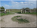
Entrance to open space, off Gisburn Road, Eastmoor
The open space is now Parkhill, part of the Southern Washlands nature corridor. It was the site of Parkhill Colliery [1877-1983] and all the paths were routes to or through the colliery.
Image: © Christine Johnstone
Taken: 8 Apr 2020
0.09 miles
2
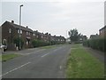
Arncliffe Road - off Windhill Road
Image: © Betty Longbottom
Taken: 20 May 2014
0.09 miles
3

Eastmoor
A view from the Pimple looking across to Eastmoor housing estate. The cranes on the horizon are on the site of the new Pinderfields hospital.
Image: © Mike Kirby
Taken: 20 May 2009
0.09 miles
4

Walkers Welcome sign
I asked some time ago if anyone could identify this sign, see Image, but never received a reply. Now, here's another one, with the words 'Walkers Welcome' included.
Mystery solved!
Image: © Mike Kirby
Taken: 4 Feb 2012
0.10 miles
5

Walking group
These hardy souls enduring sub zero temperatures to enjoy their regular Saturday walk.
(Note the sign on the fencepost).
See Image
Image: © Mike Kirby
Taken: 4 Feb 2012
0.10 miles
6

Post box on Linton Road
At the junction with Park Lodge Lane.
Image: © Stephen Craven
Taken: 25 May 2020
0.10 miles
7

Parkhill Colliery pit wheel
This wheel is all there is to show that a colliery existed here. There is no plaque or information to describe its significance.
Parkhill Colliery, whose original owners were the Hudson family, started producing coal in 1878 and closed in 1982. Coal from Parkhill was transported to its markets by canal and river for the whole of its life.
Image: © Mike Kirby
Taken: 20 May 2009
0.10 miles
8

Parkhill Colliery pit wheel
This wheel is all there is to show that a colliery existed here. There is no plaque or information to describe its significance, just the graffiti which has needlessly been added.
Parkhill Colliery, whose original owners were the Hudson family, started producing coal in 1878 and closed in 1982. Coal from Parkhill was transported to its markets by canal and river for the whole of its life.
Image: © Mike Kirby
Taken: 20 May 2009
0.10 miles
9

Parkhill Pit Wheel
The wheel looking resplendent following repainting.
See Image
Image: © Mike Kirby
Taken: 13 Mar 2011
0.11 miles
10

Stub road off Park Lodge Lane (south side)
A stub road has been left to facilitate future housing development. This is looking along the alignment of the former Parkhill Colliery branch railway line.
Image: © Stephen Craven
Taken: 25 May 2020
0.11 miles