
IMAGES TAKEN NEAR TO
Victoria Close, WAKEFIELD, WF1 4GD
Introduction
This page details the photographs taken nearby to Victoria Close, WF1 4GD by members of the Geograph project.
The Geograph project started in 2005 with the aim of publishing, organising and preserving representative images for every square kilometre of Great Britain, Ireland and the Isle of Man.

There are currently over 7.5m images from over14,400 individuals and you can help contribute to the project by visiting https://www.geograph.org.uk
Image Map
Images are licensed for reuse under creativecommons.org/licenses/by-sa/2.0
Notes
- Clicking on the map will re-center to the selected point.
- The higher the marker number, the further away the image location is from the centre of the postcode.
Image Listing (94 Images Found)
Images are licensed for reuse under creativecommons.org/licenses/by-sa/2.0
Image
Details
Distance
1
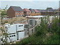
Construction site, off Neil Fox Way
Part of Wakefield's 'eastern development' aka City Fields.
Image: © Christine Johnstone
Taken: 13 Apr 2020
0.01 miles
2
![Neil Fox Way [A6194]](https://s3.geograph.org.uk/geophotos/06/44/25/6442579_dd6cdd99_120x120.jpg)
Neil Fox Way [A6194]
The spine road of Wakefield's 'eastern development', aka City Fields. The road is named after a famous Wakefield rugby league player.
Image: © Christine Johnstone
Taken: 13 Apr 2020
0.02 miles
3
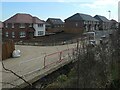
New houses on Victoria Close, City Fields, Wakefield
The building with four skylights is also in Image 10 months earlier.
Image: © Christine Johnstone
Taken: 27 Feb 2021
0.02 miles
4

Wakefield's City Fields, ready for development [7]
Future road junction on the west side of the A6194. The plan is to build houses here, on the eastern fringe of Wakefield.
Image: © Christine Johnstone
Taken: 15 Dec 2017
0.02 miles
5

Public footpath, Victoria Close, City Fields
Once a field path, then a fenced path through a construction site, now an extra-wide pavement.
Image: © Christine Johnstone
Taken: 27 Feb 2021
0.03 miles
6

Public footpath
The footpath follows the perimeter of Pinders Heath private housing estate from the A642 until you reach open countryside once more. See Image
Image: © Mike Kirby
Taken: 25 Apr 2011
0.03 miles
7
![City Fields, Wakefield East [9]](https://s1.geograph.org.uk/geophotos/04/85/15/4851505_3b80674c_120x120.jpg)
City Fields, Wakefield East [9]
Infrastructure on the west side of the new road. Part of a large housing development called 'City Fields' on all the farmland between Stanley Ferry and the current edge of Wakefield.
Image: © Christine Johnstone
Taken: 14 Feb 2016
0.03 miles
8
![City Fields, Wakefield East [4]](https://s0.geograph.org.uk/geophotos/04/74/20/4742052_62ec5641_120x120.jpg)
City Fields, Wakefield East [4]
Stacked pipes on the new road from the Doncaster Road to Aberford Road. Once completed, this will form the spine of a large housing development called 'City Fields' on all the farmland between Stanley Ferry and the current edge of Wakefield.
Image: © Christine Johnstone
Taken: 16 Nov 2015
0.03 miles
9
![City Fields, Wakefield East [6]](https://s2.geograph.org.uk/geophotos/04/74/20/4742058_12330a4f_120x120.jpg)
City Fields, Wakefield East [6]
New road from the Doncaster Road to Aberford Road crossing the existing public footpath. Once completed, this will form the spine of a large housing development called 'City Fields' on all the farmland between Stanley Ferry and the current edge of Wakefield.
Image: © Christine Johnstone
Taken: 16 Nov 2015
0.03 miles
10

Public footpath crossing the new A6194
No public footpath signs yet. For a view of the same crossing in November 2015, but in the opposite direction, see Image
Image: © Christine Johnstone
Taken: 15 Dec 2017
0.03 miles