
IMAGES TAKEN NEAR TO
Pinderhill Avenue, WAKEFIELD, WF1 4FG
Introduction
This page details the photographs taken nearby to Pinderhill Avenue, WF1 4FG by members of the Geograph project.
The Geograph project started in 2005 with the aim of publishing, organising and preserving representative images for every square kilometre of Great Britain, Ireland and the Isle of Man.

There are currently over 7.5m images from over14,400 individuals and you can help contribute to the project by visiting https://www.geograph.org.uk
Image Map
Images are licensed for reuse under creativecommons.org/licenses/by-sa/2.0
Notes
- Clicking on the map will re-center to the selected point.
- The higher the marker number, the further away the image location is from the centre of the postcode.
Image Listing (82 Images Found)
Images are licensed for reuse under creativecommons.org/licenses/by-sa/2.0
Image
Details
Distance
1
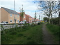
Public footpath alongside Pinderhill Avenue
New housing on a greenfield site on the north-eastern edge of Wakefield.
Image: © Christine Johnstone
Taken: 13 Apr 2020
0.03 miles
2

Pinderhill Avenue, City Fields, Wakefield
Seen from the public footpath that forms the southern boundary of this new housing estate.
Image: © Christine Johnstone
Taken: 13 Apr 2020
0.03 miles
3

Clarke Grove, off Barnstone Vale, Wakefield
A small part of a housing development built in the 1990s on the northern edge of Wakefield.
Image: © Christine Johnstone
Taken: 14 Feb 2016
0.05 miles
4
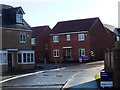
New homes on Pinderhill Avenue and The Fouracres
Part of the new City Fields development. Miller Homes built these. 'Pinderhill' is derived from the nearby Pinderfields road name, although 'Pinder' is a role, not a location.
Image: © Christine Johnstone
Taken: 15 Dec 2017
0.05 miles

6
![City Fields, Wakefield East [8]](https://s0.geograph.org.uk/geophotos/04/85/14/4851492_82012fb8_120x120.jpg)
City Fields, Wakefield East [8]
Uncultivated farmland waiting for a new crop of roads and houses. Looking north towards Stanley Hall [Wakefield Hospice]. This is the western edge of a large housing development called 'City Fields' on all the farmland between Stanley Ferry and the current edge of Wakefield.
Image: © Christine Johnstone
Taken: 14 Feb 2016
0.06 miles
7

Miller Homes, 'the place to be', at Wakefield's City Fields
Immediately east of the Aberford Road roundabout.
Image: © Christine Johnstone
Taken: 15 Dec 2017
0.06 miles
8
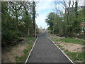
City Fields footpath, Wakefield
Tarmac path heading north from the public footpath.
Image: © Christine Johnstone
Taken: 13 Apr 2020
0.09 miles
9
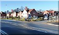
Bellway's Sales Centre at Wakefield's City Fields
Immediately east of the Aberford Road roundabout.
Image: © Christine Johnstone
Taken: 15 Dec 2017
0.09 miles
10

Haldane Crescent - Barnstone Vale
Image: © Betty Longbottom
Taken: 14 Jan 2014
0.10 miles