
IMAGES TAKEN NEAR TO
Monk Street, WAKEFIELD, WF1 4EW
Introduction
This page details the photographs taken nearby to Monk Street, WF1 4EW by members of the Geograph project.
The Geograph project started in 2005 with the aim of publishing, organising and preserving representative images for every square kilometre of Great Britain, Ireland and the Isle of Man.

There are currently over 7.5m images from over14,400 individuals and you can help contribute to the project by visiting https://www.geograph.org.uk
Image Map
Images are licensed for reuse under creativecommons.org/licenses/by-sa/2.0
Notes
- Clicking on the map will re-center to the selected point.
- The higher the marker number, the further away the image location is from the centre of the postcode.
Image Listing (523 Images Found)
Images are licensed for reuse under creativecommons.org/licenses/by-sa/2.0
Image
Details
Distance
1

Signpost
These signposts can be found all over the town centre. This one is in Monk Street near Kirkgate station. Note the Fleur-de-lis of Wakefield on top
Image: © Mike Kirby
Taken: 15 Jan 2009
0.02 miles
2

Signpost
These signposts can be found all over the town centre. This one is in Monk Street, (Kirkgate station in background). Note the Fleur-de-lis of Wakefield on top.
Image: © Mike Kirby
Taken: 15 Jan 2009
0.02 miles
4

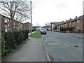
It is the mind...
This contemporary wall opposite the entrance to Kirkgate station bears the inscription "It is the mind which creates the world around us". A good starting point for a philosophical discussion in a pub. A pity the one across the road has closed ...Image
Image: © Stephen Craven
Taken: 22 Nov 2016
0.02 miles
5

TPT information board
This Trans Pennine Trail information board is located by the entrance to Kirkgate railway station.
Image: © Mike Kirby
Taken: 31 May 2009
0.03 miles
6

Mortal remains of the Wakefield Arms
Perhaps the virtual dereliction at Wakefield Kirkgate railway station (just visible in the background on the left) went unnoticed for so long because of this fine example of actual dereliction, on the corner of Monk Street (foreground) and Park Street (right). The Wakefield Arms does not appear to be in danger of falling down, but neither does it appear to be in danger of opening.
Image: © Richard Vince
Taken: 28 Nov 2015
0.03 miles
7
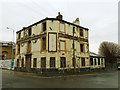
The former Wakefield Arms
This former pub on the corner of Monk Street (foreground) and Park Street, dating from 1830 (ten years before the nearby railway station) has been closed for a considerable time (since 2003 according to http://www.closedpubs.co.uk/yorkshire/wakefield_wakefieldarms.html ) and is now derelict. It would probably have been demolished except that it is grade 2 listed (list entry 1245773) as "the only surviving example of a building covered with Joseph Aspdin's patent Portland cement".
Image: © Stephen Craven
Taken: 22 Nov 2016
0.03 miles
8

Development of the former Wakefield Arms
See Image for a photo from a previous visit in 2016. It is grade 2 listed (list entry 1245773) as "the only surviving example of a building covered with Joseph Aspdin's patent Portland cement". The building appears to have been stripped back to that cement render, awaiting further restoration, and an extension has already been added.
Image: © Stephen Craven
Taken: 31 Aug 2020
0.03 miles
9
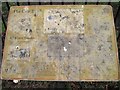
The City Trail information board
This City Trail information board in Monk Street has been so badly vandalised it is virtually unreadable.
Image: © Mike Kirby
Taken: 15 Jan 2009
0.03 miles
