
IMAGES TAKEN NEAR TO
Stumps Close, WAKEFIELD, WF1 3RA
Introduction
This page details the photographs taken nearby to Stumps Close, WF1 3RA by members of the Geograph project.
The Geograph project started in 2005 with the aim of publishing, organising and preserving representative images for every square kilometre of Great Britain, Ireland and the Isle of Man.

There are currently over 7.5m images from over14,400 individuals and you can help contribute to the project by visiting https://www.geograph.org.uk
Image Map
Images are licensed for reuse under creativecommons.org/licenses/by-sa/2.0
Notes
- Clicking on the map will re-center to the selected point.
- The higher the marker number, the further away the image location is from the centre of the postcode.
Image Listing (91 Images Found)
Images are licensed for reuse under creativecommons.org/licenses/by-sa/2.0
Image
Details
Distance

4

East Street, Newton Hill, in snow
A light sprinkling of fluffy snow covers East Street. This shot makes it look quite wide, but in reality it is a very snug fit with parked cars both sides, and getting into a parking space can be really difficult. Turning round is even more difficult in this dead end with no turning area. It has a 'no parking on refuse collection day' rule, but that all goes wrong over the Christmas period.
Image: © John Goldsmith
Taken: 3 Jan 2010
0.06 miles
5
Umpire Close, off Boundary Drive
Wicket Drive, Bowlers Court, Spinners Avenue, The Oval, Trent Bridge Way and Headingley Mews are all nearby. Is there a theme emrging?
Image: © Christine Johnstone
Taken: 30 Jan 2011
0.06 miles

7

Sunrise at Newton Hill, Wakefield
The hill behind East Street - probably a colliery waste tip - is illuminated by the sunrise. A tower crane is also visible on the right.
Image: © John Goldsmith
Taken: 23 Oct 2008
0.06 miles

9
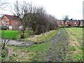
Contrasting footpaths on the northern edge of Wakefield
Muddy field edge public footpath heading west to older houses on Newton Hill's East Avenue. Suburban metalled path heading south to newer houses in Wakefield's 'cricketer' estate.
Image: © Christine Johnstone
Taken: 25 Jan 2015
0.07 miles
10
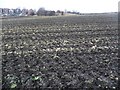
Recently harvested cabbage field
At 84 metres, this is the highest point on the north side of Wakefield, with views for miles.
Image: © Christine Johnstone
Taken: 30 Jan 2011
0.09 miles