
IMAGES TAKEN NEAR TO
Ouchthorpe Fold, WAKEFIELD, WF1 3HR
Introduction
This page details the photographs taken nearby to Ouchthorpe Fold, WF1 3HR by members of the Geograph project.
The Geograph project started in 2005 with the aim of publishing, organising and preserving representative images for every square kilometre of Great Britain, Ireland and the Isle of Man.

There are currently over 7.5m images from over14,400 individuals and you can help contribute to the project by visiting https://www.geograph.org.uk
Image Map
Images are licensed for reuse under creativecommons.org/licenses/by-sa/2.0
Notes
- Clicking on the map will re-center to the selected point.
- The higher the marker number, the further away the image location is from the centre of the postcode.
Image Listing (67 Images Found)
Images are licensed for reuse under creativecommons.org/licenses/by-sa/2.0
Image
Details
Distance

2

The Nightingale
Located on Newton Lane, Bolus Lane junction.
Image: © Mike Kirby
Taken: 1 Aug 2008
0.07 miles
3
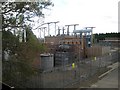
Electricity sub-station
This sub-station is quite large, but is hidden from view by all the surrounding houses.
Image: © Mike Kirby
Taken: 1 Aug 2008
0.08 miles

5
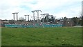
Northern Powergrid's electricity sub-station, near Outwood
Accessed from Ouchthorpe Lane.
Image: © Christine Johnstone
Taken: 31 Mar 2020
0.08 miles


8

Old school house
Built in 1840 as St Mary Magdalene’s National School, it was paid for by the local parish and run by the National Society, the Church of England’s educational arm. It closed in 1872 as it was unable to compete with ratepayer funded ‘board schools’ which were established in 1870.
It has been tastefully converted into a private residence, and is currently up for sale.
Image: © Mike Kirby
Taken: 1 Aug 2008
0.09 miles
9
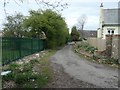
Public footpath and former mineral line, off Ouchthorpe Lane
On the route of the railway that took coal from Newton Lane pit [part of the Victoria Colliery complex] to the canal at Stanley Ferry.
Image: © Christine Johnstone
Taken: 31 Mar 2020
0.10 miles
