
IMAGES TAKEN NEAR TO
Cartwright Drive, WAKEFIELD, WF1 3FG
Introduction
This page details the photographs taken nearby to Cartwright Drive, WF1 3FG by members of the Geograph project.
The Geograph project started in 2005 with the aim of publishing, organising and preserving representative images for every square kilometre of Great Britain, Ireland and the Isle of Man.

There are currently over 7.5m images from over14,400 individuals and you can help contribute to the project by visiting https://www.geograph.org.uk
Image Map
Images are licensed for reuse under creativecommons.org/licenses/by-sa/2.0
Notes
- Clicking on the map will re-center to the selected point.
- The higher the marker number, the further away the image location is from the centre of the postcode.
Image Listing (270 Images Found)
Images are licensed for reuse under creativecommons.org/licenses/by-sa/2.0
Image
Details
Distance
1
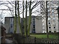
CLASP buildings at the Police Training College
CLASP stands for Consortium of Local Authorities Special Programme, but is also referred to as Collection of Loosely Assembled Steel Parts. It was developed from 1957 for building schools, but was also used in the 1960s and early 1970s for the University of York.
Image: © Christine Johnstone
Taken: 25 Jan 2015
0.02 miles
2
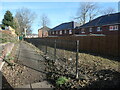
Do fences make good neighbours along a Wakefield footpath?
A new housing estate has been built on the old police training college site. The back gardens in Blenheim Road to the left - one has almost no wall, the other has added a high wooden fence. New low railings along the public footpath give way in the distance to the high security fences installed when it was a building site. And the new houses all have high wooden fences around their back gardens.
Image: © Christine Johnstone
Taken: 30 Jan 2022
0.03 miles
3

Summer house above the public footpath to Bar Lane
Demonstrating the difference in ground level between Blenheim Road back gardens and the footpath on their boundary.
Image: © Christine Johnstone
Taken: 10 Apr 2021
0.03 miles
4
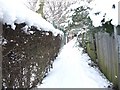
Snowy footpath, heading north
There had been about 9 inches of snow in the previous two days, and no thaw.
Image: © Christine Johnstone
Taken: 7 Jan 2010
0.03 miles
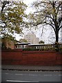
6
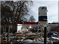
Cemex mortar silo, Redrow's building site, Wakefield
On the former site of the police training college.
Image: © Christine Johnstone
Taken: 16 Dec 2018
0.04 miles
7
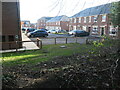
Open space, western end of Cartwright Drive
A new Redrow housing development on the site of the West Yorkshire police training college.
Image: © Christine Johnstone
Taken: 30 Jan 2022
0.04 miles
8
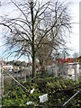
A protected row of trees on the police training college site
Redrow is building houses on the site. In 1890 a row of trees were mapped this boundary, behind Croft House and Grove Villa.
Image: © Christine Johnstone
Taken: 16 Dec 2018
0.04 miles
9
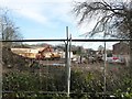
Construction site, off College Grove Road
Redrow are building a housing estate on the site of the police training college.
Image: © Christine Johnstone
Taken: 16 Dec 2018
0.06 miles
10

The West Yorks police training school has moved to Carr Gate
The old site Image off Westfield Road, has been demolished, to make way for Redrow houses.
Image: © Christine Johnstone
Taken: 14 May 2018
0.06 miles