
IMAGES TAKEN NEAR TO
Snow Hill Way, WAKEFIELD, WF1 2UZ
Introduction
This page details the photographs taken nearby to Snow Hill Way, WF1 2UZ by members of the Geograph project.
The Geograph project started in 2005 with the aim of publishing, organising and preserving representative images for every square kilometre of Great Britain, Ireland and the Isle of Man.

There are currently over 7.5m images from over14,400 individuals and you can help contribute to the project by visiting https://www.geograph.org.uk
Image Map
Images are licensed for reuse under creativecommons.org/licenses/by-sa/2.0
Notes
- Clicking on the map will re-center to the selected point.
- The higher the marker number, the further away the image location is from the centre of the postcode.
Image Listing (44 Images Found)
Images are licensed for reuse under creativecommons.org/licenses/by-sa/2.0
Image
Details
Distance
1

Persimmon's marketing suite, Ruby Street, Wakefield
Apparently the estate is called Kingsbury Meadows.
Image: © Christine Johnstone
Taken: 26 Feb 2021
0.04 miles
2

Aldi and Poundworld stores
Aldi and Poundworld stores on the Snowhill Retail Park on the northern edge of the city of Wakefield.
Image: © Philip Halling
Taken: 30 Jun 2018
0.05 miles
3
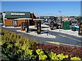
A drive-thru McDonald's
A drive-thru McDonald's on the Snowhill Retail Park in Wakefield. I can't remember the last time I ate a McDonald's burger; it reminds me of a line from the film 'Crocodile Dundee'. I shall say no more.
Image: © Philip Halling
Taken: 30 Jun 2018
0.06 miles
4

Drive Through
Showing the business end of this drive through.
Image: © Mike Kirby
Taken: 28 Sep 2008
0.08 miles

7

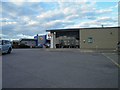
"Roadside development opportunities", Wakefield
Vacant land on the north side of the A650, opposite the Snowhill retail development. The terraced houses are on the west side of the Leeds Road [A61].
Image: © Christine Johnstone
Taken: 26 Feb 2021
0.09 miles
8
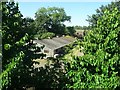
A glimpse of the past
Farm buildings viewed from a stairwell window in Wakefield City North, Premier Inn. This area was known as the 'Rhubarb Triangle' and though much of this land has been developed in recent years these farm buildings are still standing to the rear of the hotel giving a glimpse of what was here before.
Image: © Philip Halling
Taken: 29 Jun 2018
0.09 miles
9
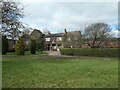
Red Hall, from Red Hall Lane, Wakefield
So-called because it was built of red brick, rather than stone. Built around 1610 and Grade 2 listed.
Image: © Christine Johnstone
Taken: 26 Feb 2021
0.10 miles
10
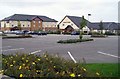
Premier Inn
This Premier Inn is located in the Paragon Business Village off the A650. The adjoining pub and restaurant is called Rhubarb Triangle, another reference to Wakefields connection to rhubarb growing within the district.
Image: © Mike Kirby
Taken: 28 Sep 2008
0.10 miles