IMAGES TAKEN NEAR TO
Leeds Road, WAKEFIELD, WF1 2JD
Introduction
This page details the photographs taken nearby to Leeds Road, WF1 2JD by members of the Geograph project.
The Geograph project started in 2005 with the aim of publishing, organising and preserving representative images for every square kilometre of Great Britain, Ireland and the Isle of Man.

There are currently over 7.5m images from over14,400 individuals and you can help contribute to the project by visiting https://www.geograph.org.uk
Image Map
Images are licensed for reuse under creativecommons.org/licenses/by-sa/2.0
Notes
- Clicking on the map will re-center to the selected point.
- The higher the marker number, the further away the image location is from the centre of the postcode.
Image Listing (76 Images Found)
Images are licensed for reuse under creativecommons.org/licenses/by-sa/2.0
Image
Details
Distance
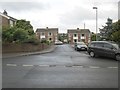
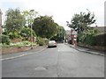
3
Junction of Grey Street and Grey Court, Newton Hill
On the site of Newton Lane pit and the mineral lines that served it.
Image: © Christine Johnstone
Taken: 31 Mar 2020
0.06 miles
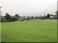
7

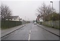
Hedley Crescent - viewed from Moxon Grove
Image: © Betty Longbottom
Taken: 14 Oct 2013
0.09 miles
8
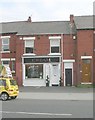
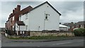
Cream beauty & tanning - Leeds Road
Image: © Betty Longbottom
Taken: 3 Sep 2010
0.09 miles
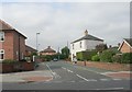
9
Victoria Approach - viewed from Victoria Way
Image: © Betty Longbottom
Taken: 14 Oct 2013
0.09 miles