
IMAGES TAKEN NEAR TO
Whitaker Drive, WAKEFIELD, WF1 2FJ
Introduction
This page details the photographs taken nearby to Whitaker Drive, WF1 2FJ by members of the Geograph project.
The Geograph project started in 2005 with the aim of publishing, organising and preserving representative images for every square kilometre of Great Britain, Ireland and the Isle of Man.

There are currently over 7.5m images from over14,400 individuals and you can help contribute to the project by visiting https://www.geograph.org.uk
Image Map
Images are licensed for reuse under creativecommons.org/licenses/by-sa/2.0
Notes
- Clicking on the map will re-center to the selected point.
- The higher the marker number, the further away the image location is from the centre of the postcode.
Image Listing (61 Images Found)
Images are licensed for reuse under creativecommons.org/licenses/by-sa/2.0
Image
Details
Distance

2
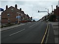
Pedestrian crossing, Leeds Road, Newton Hill
Outside the entrance to a primary school.
Image: © Christine Johnstone
Taken: 31 Mar 2020
0.07 miles
3

Derelict building, Newton Hill
The faded advertisement on the side wall reads "John Smiths Magnet Ales" Image
Image: © Mike Kirby
Taken: 27 Nov 2008
0.07 miles

5

Former Library, Newton Hill
This building has stood empty for years, slowly decaying, but I seem to recollect that there is some sort of preservation order on it. Newton Hill Library was adapted from a shop in 1966, and replaced by the newly built Outwood Library Image in 1983 due to its restricted size.
Image: © Mike Kirby
Taken: 27 Nov 2008
0.08 miles
6

Leeds Road - viewed from First Avenue
Image: © Betty Longbottom
Taken: 14 Oct 2013
0.08 miles
7

Newton Hill Primary School, Wakefield
Viewed from the rear, from East Street.
More details at http://www.axcis.co.uk/33897.html
The front of the school and the houses visible in the back of the shot are in Leeds Road.
Do you think 'The Crayons' are the Primary School version of the Krays?
Image: © John Goldsmith
Taken: 23 Oct 2008
0.08 miles

9

Housing development on Red Hall Lane
New buildings between the A61 and A650 north of central Wakefield.
Image: © John Allan
Taken: 12 Mar 2015
0.09 miles
10

Newton Hill Primary School in the snow
The back of the primary school is viewed here from a mound which is believed to consist of colliery waste - it certainly has coal like material in it. In between the mound and the school there are some allotments and a recreation field. Beyond the school we can just see the houses of Leeds Road.
Image: © John Goldsmith
Taken: 3 Jan 2010
0.10 miles