
IMAGES TAKEN NEAR TO
Cliff Park Avenue, WAKEFIELD, WF1 2DW
Introduction
This page details the photographs taken nearby to Cliff Park Avenue, WF1 2DW by members of the Geograph project.
The Geograph project started in 2005 with the aim of publishing, organising and preserving representative images for every square kilometre of Great Britain, Ireland and the Isle of Man.

There are currently over 7.5m images from over14,400 individuals and you can help contribute to the project by visiting https://www.geograph.org.uk
Image Map
Images are licensed for reuse under creativecommons.org/licenses/by-sa/2.0
Notes
- Clicking on the map will re-center to the selected point.
- The higher the marker number, the further away the image location is from the centre of the postcode.
Image Listing (337 Images Found)
Images are licensed for reuse under creativecommons.org/licenses/by-sa/2.0
Image
Details
Distance
1

Cliff Park Avenue
I was hoping to find a cut through from this street to St John's Square behind, but if there is one I didn't find it.
Image: © Stephen Craven
Taken: 29 Jun 2018
0.04 miles
2
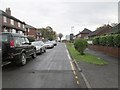
Cliffe Park Avenue - looking towards Balne Lane
Image: © Betty Longbottom
Taken: 11 Nov 2013
0.04 miles
3
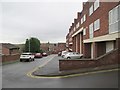
Hodgson Street - off St John's Court
Image: © Betty Longbottom
Taken: 11 Nov 2013
0.06 miles
4

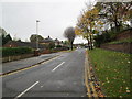
Modern block, Wakefield Girls' High School, Margaret Road, Wakefield
On a day of brilliant sunshine and hard shadows.
Image: © Robin Stott
Taken: 30 Jun 2018
0.07 miles
6

St John's Square [2]
The terrace containing numbers 2 to 9, St John's Square, is part of a planned Georgian development of circa 1800. Listed, grade II, with details at: https://www.historicengland.org.uk/listing/the-list/list-entry/1273435
Image: © Michael Dibb
Taken: 30 Jun 2018
0.08 miles
7

No.2, St John's Square
No.2, St John's Square was once the home of John Lee, the man behind the development of St John's in the 1790s. It was later used as premises for Wakefield Girls Junior High School. It is a grade II listed building in this conservation area.
Image: © Mike Kirby
Taken: 11 Jan 2009
0.08 miles
8

Fine gateway
This gateway into Wakefield Girls' High School is in the corner of St John's Square.
Image: © Michael Dibb
Taken: 30 Jun 2018
0.08 miles
9

Nos. 2 to 9 (cons) St. John?s Square
Nos. 2 to 9 (cons) St. John’s Square, west side, are grade II listed buildings in this conservation area.
Image: © Mike Kirby
Taken: 11 Jan 2009
0.08 miles
10
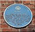
Blue Plaque - John Lee
This plaque can be found at No 2, St Johns Square. Image The plaque also refers to the Lake Lock rail road. See Image
Image: © Mike Kirby
Taken: 11 Jan 2009
0.08 miles